GRASS GIS 8: from Desktop to Big Data Cubes
Verónica Andreo
& Vaclav Petras, Martin Landa, Anna Petrasova, Guido Riembauer,
Māris Nartišs, Moritz Lennert, Markus Metz, Stefan Blumentrath,
Huidae Cho, Markus Neteler

Open Data Science Europe Workshop - Wageningen, 2021
About the presenter...
- PhD in Biology and MSc in Remote Sensing and GIS
- Researcher and lecturer at Gulich Institute from the Argentinean Space Agency - CONAE, working on applications of RS & GIS for disease ecology
- GRASS GIS dev team and PSC Chair
- OSGeo Charter member
- FOSS4G enthusiast and advocate

Which GRASS?
- GRASS GIS (Geographic Resources Analysis Support System), a FOSS suite used for geospatial data management and analysis, image processing, spatial modeling, and visualization.
- Originally developed by the U.S. Army CERL for land management and environmental planning (1982-1995).
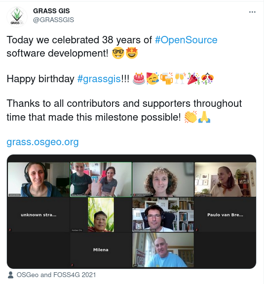
- 38 years of continuous geospatial development
A bit of (geek) GRASS GIS history...
In case you didn't notice, the video is narrated by William Shatner
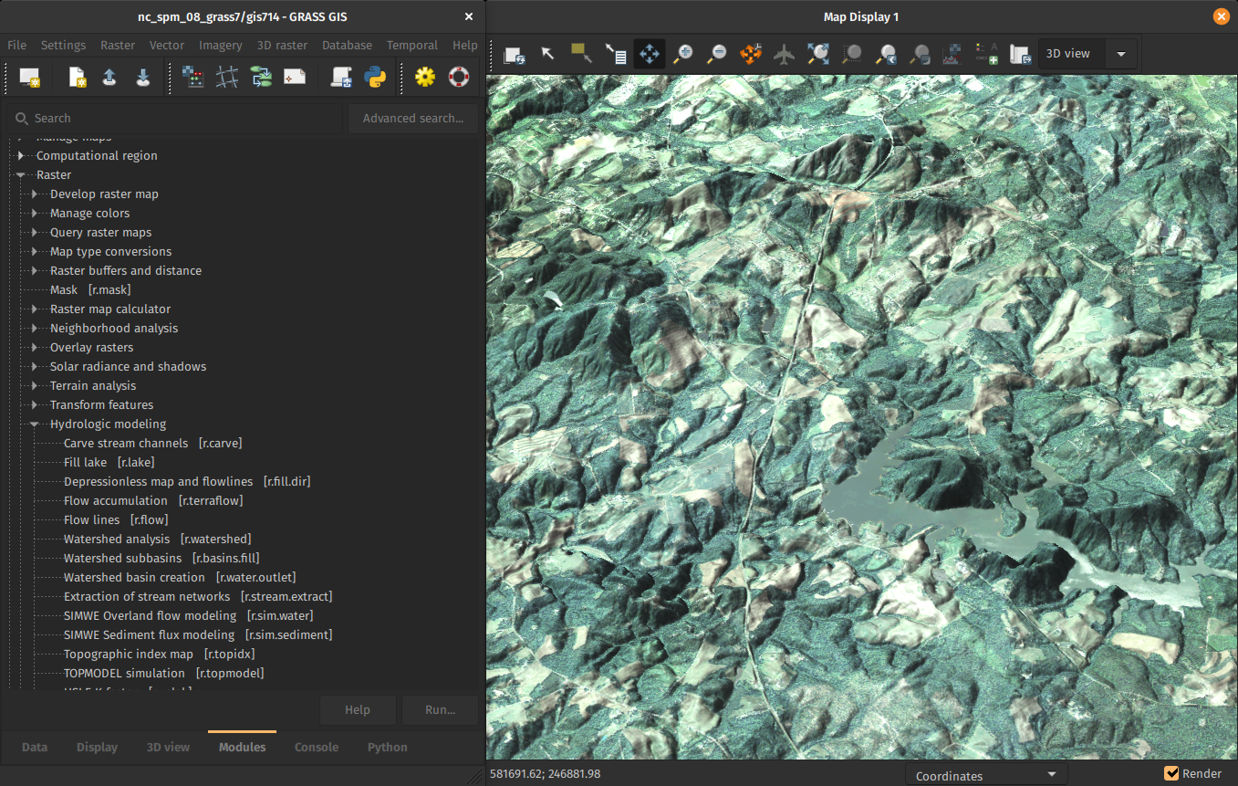
GRASS GIS general features
- Free and open source, you can use, modify, improve, share
- Large amount of tools: +500 core modules, +300 addons
- Graphical User Interface and command line
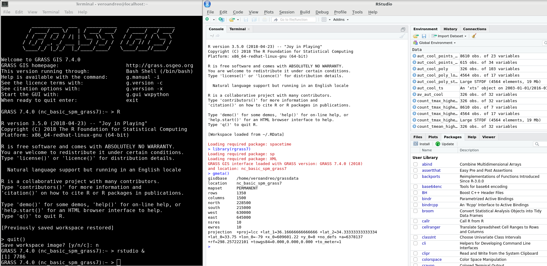
- C API, Python API and libraries
- Interface/connection with R, QGIS, WPS, etc.
- Different data types supported: raster (including satellite imagery), 3D raster or voxel, vector and, space-time datasets.
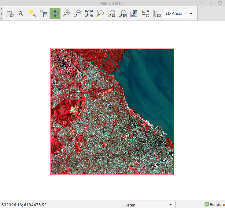
Interfaces
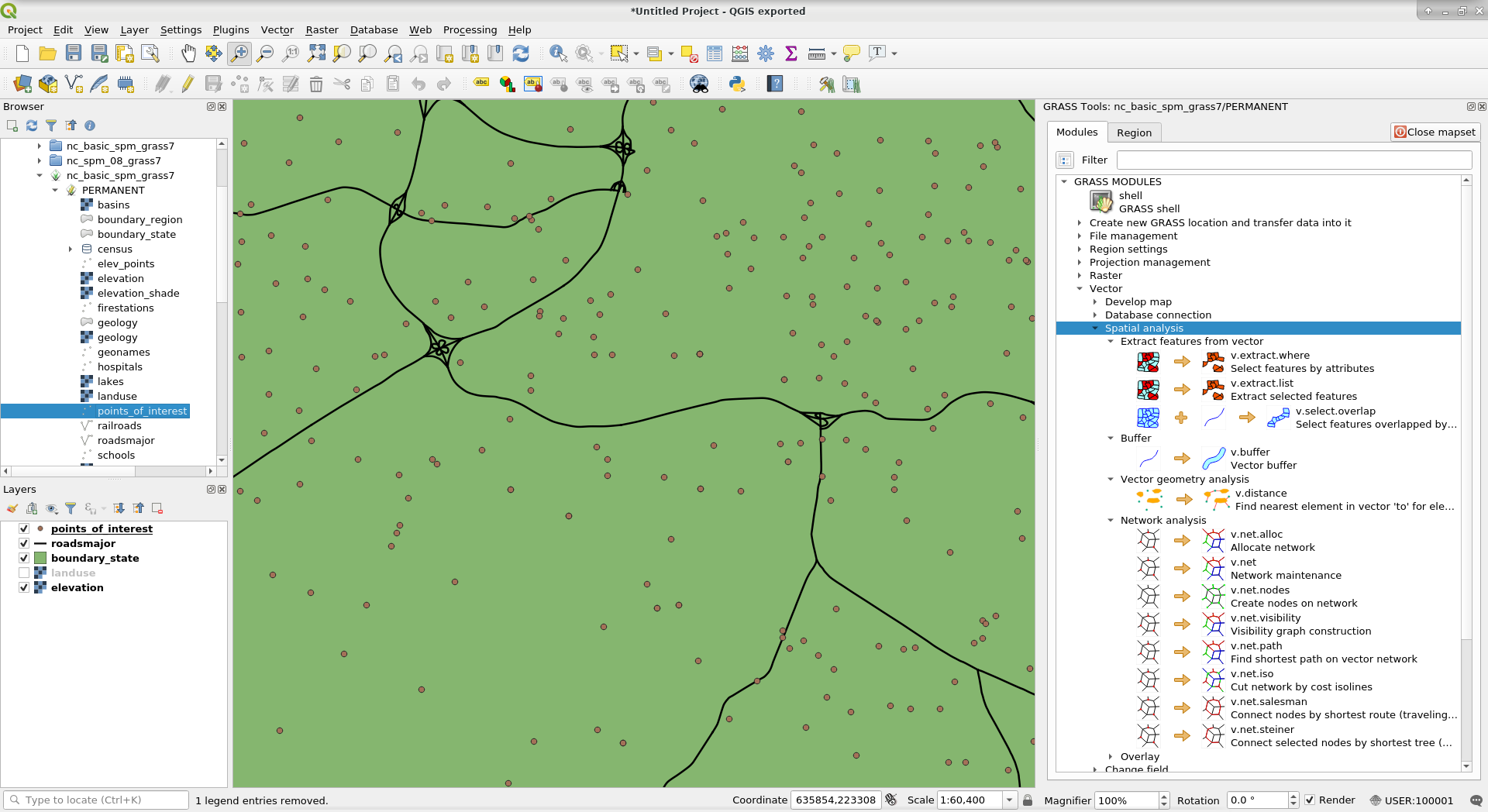
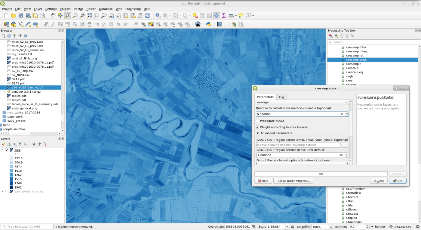
Interfaces
All-in-one software suite
- All matured tools available right away
- Download of experimental tools possible
- Network analysis, hydrology, remote sensing, OBIA, time series, …
Cool stuff that has been there for a while...

64-bit and large file support in all Operating Systems
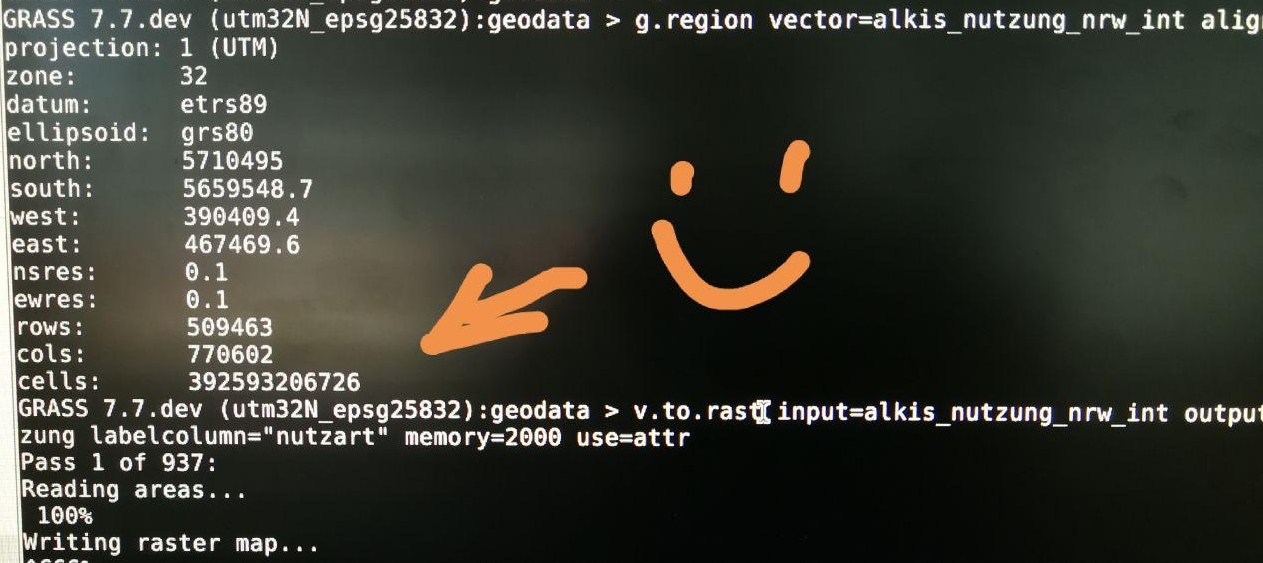
392 billion cells!
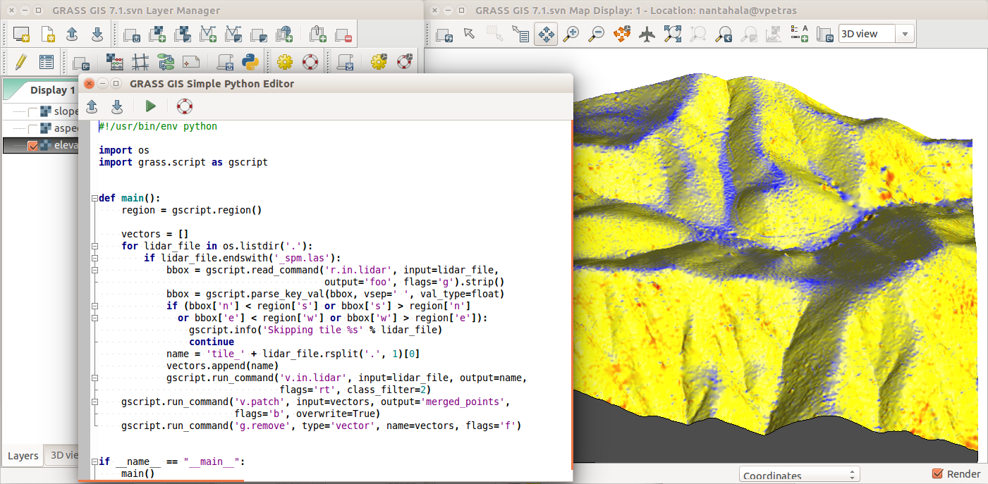
Time series support
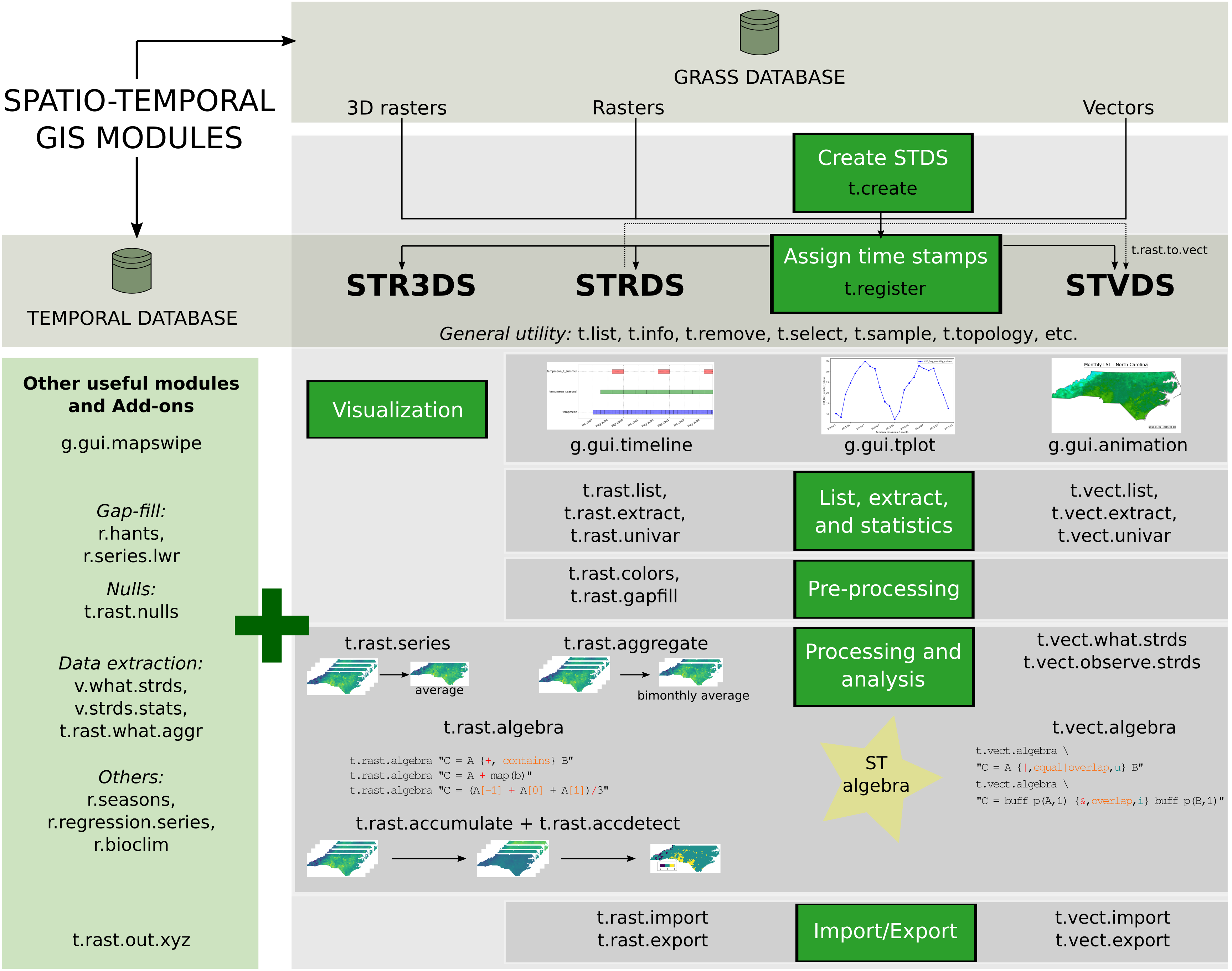

by Sören Gebbert, Luca Delucchi, Anna Petrasova, …
FUTURES
r.futures - set of tools for urban growth modeling
Improved scalability, new validation modules
by NC State Center for Geospatial Analytics
PoPS
r.pops.spread - Pest or Pathogen Spread simulation
by NC State Center for Geospatial Analytics
Tangible Landscape
Geospatial tangible user interface
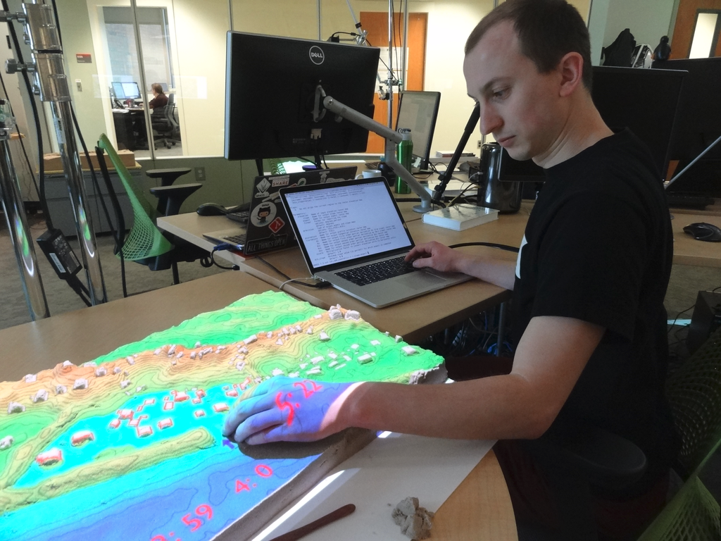
by NC State Center for Geospatial Analytics
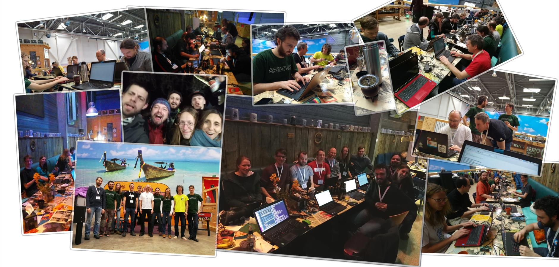
Community & Shared Improvements
- Provides software to the public.
- Shares its source code.
- Includes latest additions.
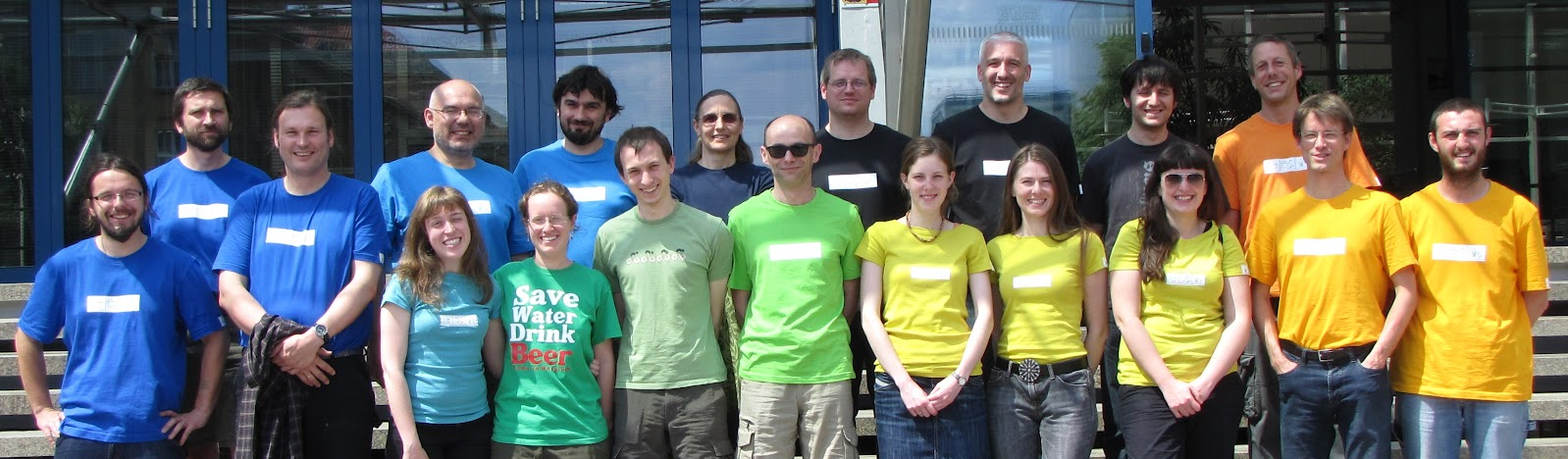
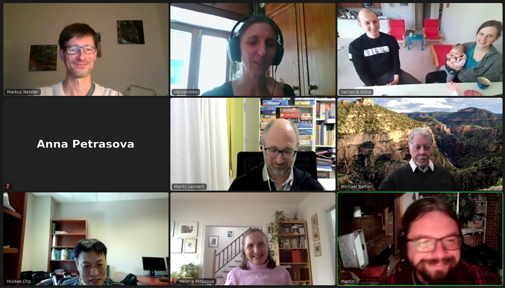
Credit goes to the whole community, not just this talk's authors
Real Global Community
- Open community of users and developers
- Contributors to code, documentation, translations, …
- Project Steering Committee
Scientific Foundations
- references to related scientific papers
- references to papers associated with tools or libraries
- tools used in open science
GRASS GIS google scholar profile
Innovation with stability
- Graphical user interface changes as needed.
- Python API added in v6, extended in v7.
- Basic things continue to work in the same way.
Raster algebra expression from 2002 (v5) in 2021 (v8):
        depressions =
        if((elevation - fill) < 0, 1, 0)
Support
- Community support
- user mailing list (with vast archives since 1991)
- GIS StackExchange
- Discussions on GitHub
- …
- Commercial support
GRASS GIS 8
- Roadmap:
- 7.8.6 Fall 2021
- Old but still good.
- 8.0.0 Fall 2021
- First release in a new era.
- 8.0.1 Winter 2021
- What did we miss?
- 8.2.0 Spring 2022
- Enjoy the GSoC 2021 results!
- 7.8.6 Fall 2021
Exciting new features in GRASS 8
Dark Theme Support
Interface respects system dark theme.
by Anna Petrasova, Nicklas Larsson
Improved First-time User Experience
Initial project sets up automatically. Guidance provided for next steps.
by Linda Kladivova & rest of the community (many reviews, calls, user surveys, …)
Improved First-time User Experience
Centralized Data Management
All data manipulation centered around revamped Data tab.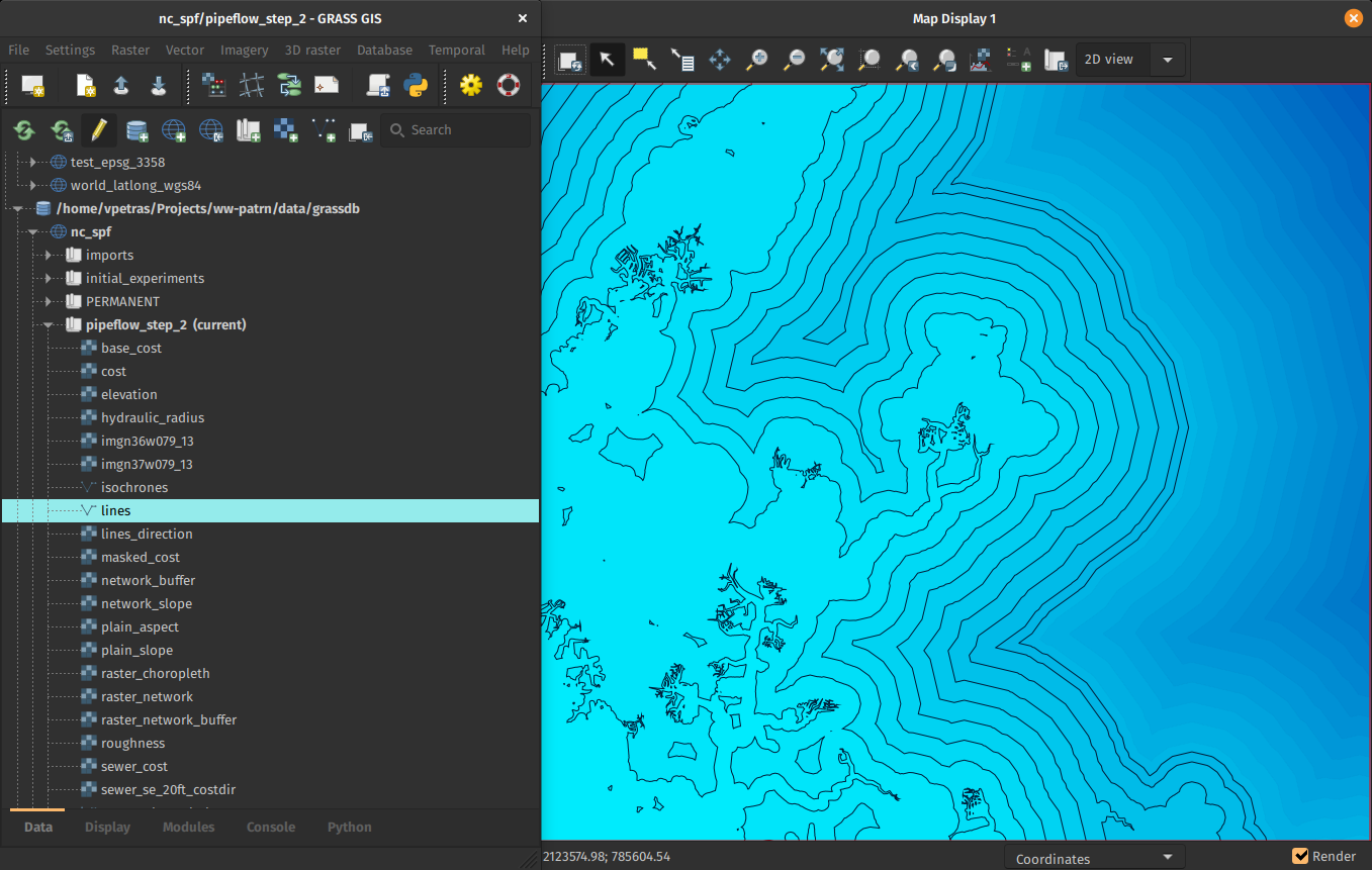
by Linda Kladivova, Anna Petrasova, Vaclav Petras
Raster band references and portable signature files
- assign a band reference (semantic label) to any raster map
- extended metadata for band reference
- band references stored in classification signature files
- signature files can be used for classification if band references match (raster values are semantically equal)
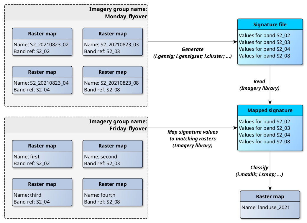
by Māris Nartišs and Martin Landa
Faster External Data Links
r.external links (opens) external raster data (GeoTiffs, …) faster.(2-5× faster, or almost no time for some workflows)
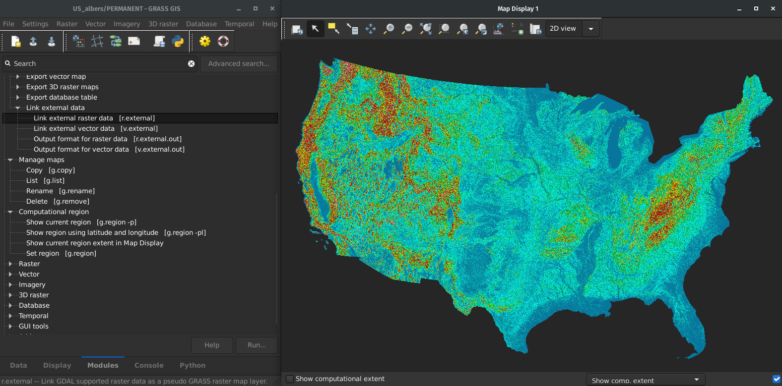
by Markus Metz
Great for workflows when only portion of the data is processed in GRASS GIS.
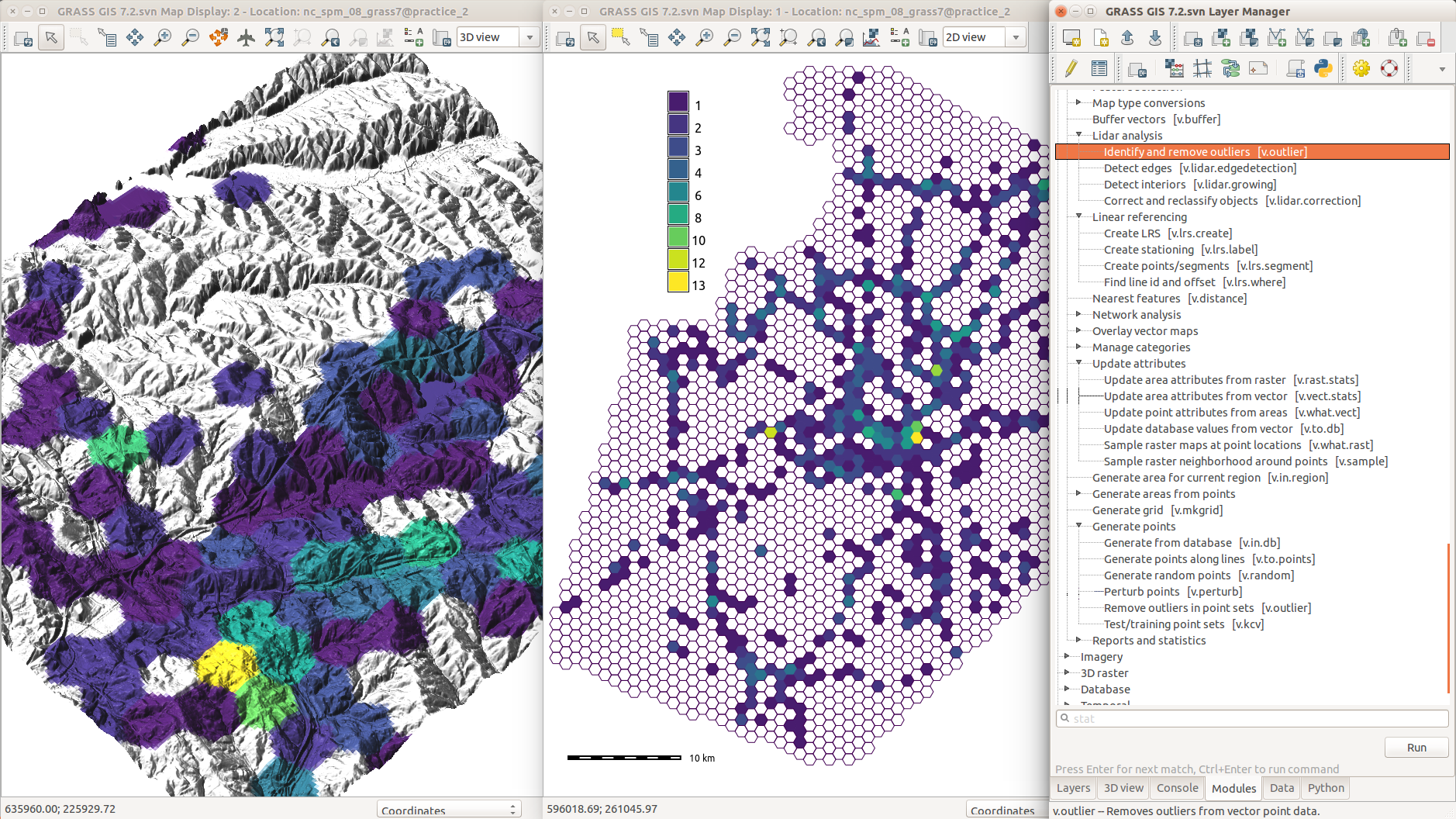
LiDAR data import with PDAL
- import of any point dimension (including user defined ones e.g. from PDAL filters)
- support of 19 binning methods (including eigenvalues)
- point filtering by values in any dimension
by Vaclav Petras and Māris Nartišs
Skeletons and Centerlines
v.voronoi tool can now create area skeletons and centerlines.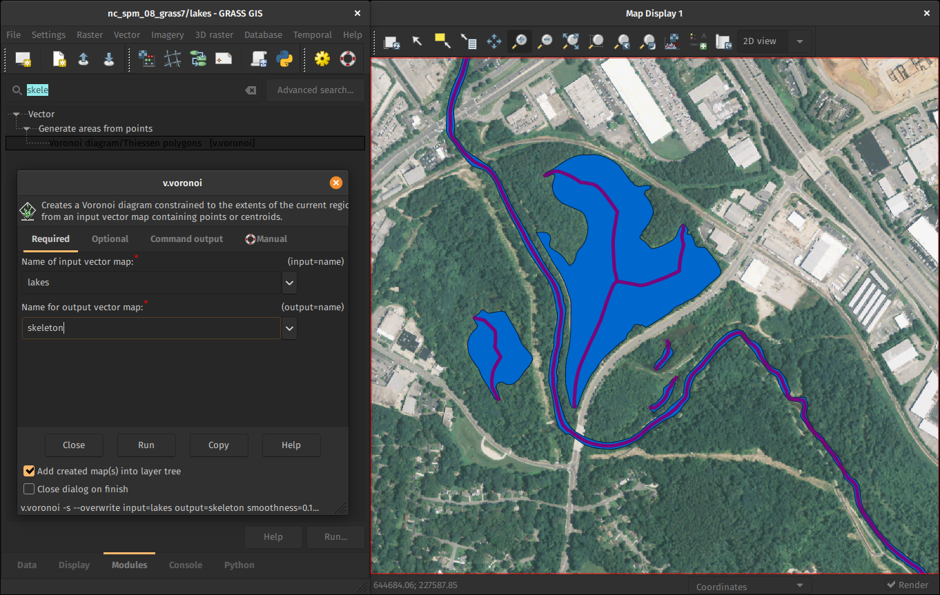
by Markus Metz
Latest PROJ and GDAL
- Support for PROJ >=6 added.
- Support for GDAL >=3 added.
- WKT2 can be used for CRS definitions.
- High-accuracy coordinate transformations supported.
by Markus Metz
Improved and robust code quality checks
- Python code formatted by Black.
- Python code checked against Flake8.
- Most of warnings in C code removed and now checked.
- Code tested with CodeQL.
- Flake8 and Black checks also for Addons.
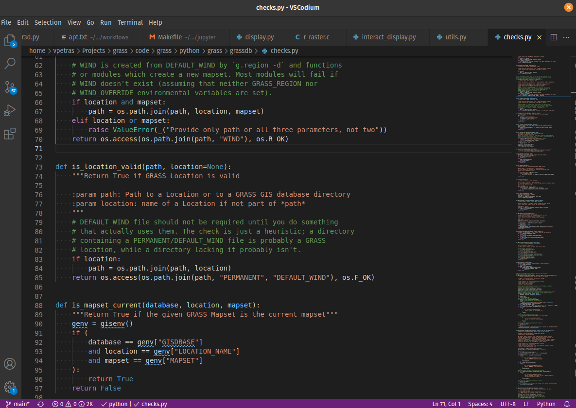
by Nicklas Larsson, Vaclav Petras, Anna Petrasova, Carmen Tawalika, ...
Google Summer of Code 2021
OpenMP parallelization by Aaron Saw Min Sern
- r.series
- r.univar
- r.neighbors
- r.patch
- r.resamp.interp
- r.resamp.filter
- r.mfilter
- r.slope.aspect
+ benchmarking library
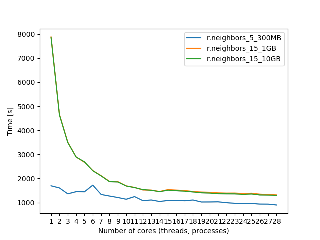
Coming in 8.2
Google Summer of Code 2021
Single-Window GUI by Linda Kladivova
Code refactoring to enable Single-Window GUI with dockable widgets.
Coming in 8.2
Google Summer of Code 2021
Integration of GRASS GIS and Jupyter Notebooks by Caitlin Haedrich
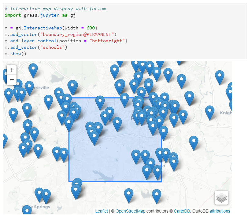
New Python library that simplifies the launch of GRASS GIS in Jupyter and the interactive display of raster/vector data.
Many new addons contributed by the community
Spatial Query of Projections
g.projpicker queries projections spatially using user-drawn geometries and set-theoretic logical operators. It requires ProjPicker.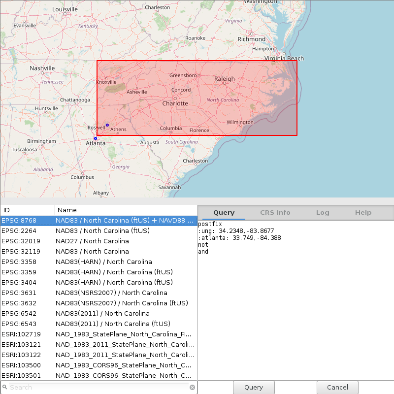
by Huidae Cho
Hydrologic Parameters Using a Flow Direction Raster
r.accumulate calculates weighted flow accumulation, subwatersheds, stream networks, and longest flow paths using a flow direction map.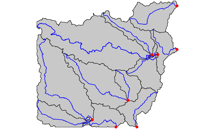
by Huidae Cho
Creating a Gabor filter bank
i.gabor creates directional filters for image segmentation using i.segment. It requires NumPy and SciPy.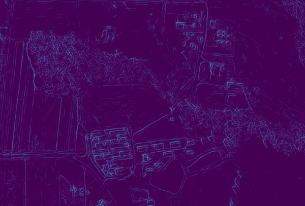
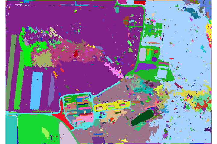
by Owen Smith
Ecological applications
r.suitability.regions allows to identify suitable regions, e.g., for species in danger, starting from suitability maps.

by Paulo van Breugel
Weighted layers for dasymetric mapping
r.area.createweight creates a weighting layer for dasymetric mapping using a random forest regression model.
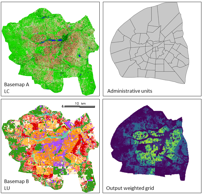
by Charlotte Flasse, Tais Grippa and Safa Fennia. DOI.
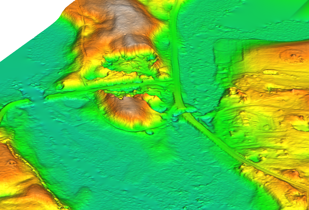
Can you see that landslide??
r.survey allows to assess whether objects of certain size could be detected by an observer moving along roads or sitting on a flying object
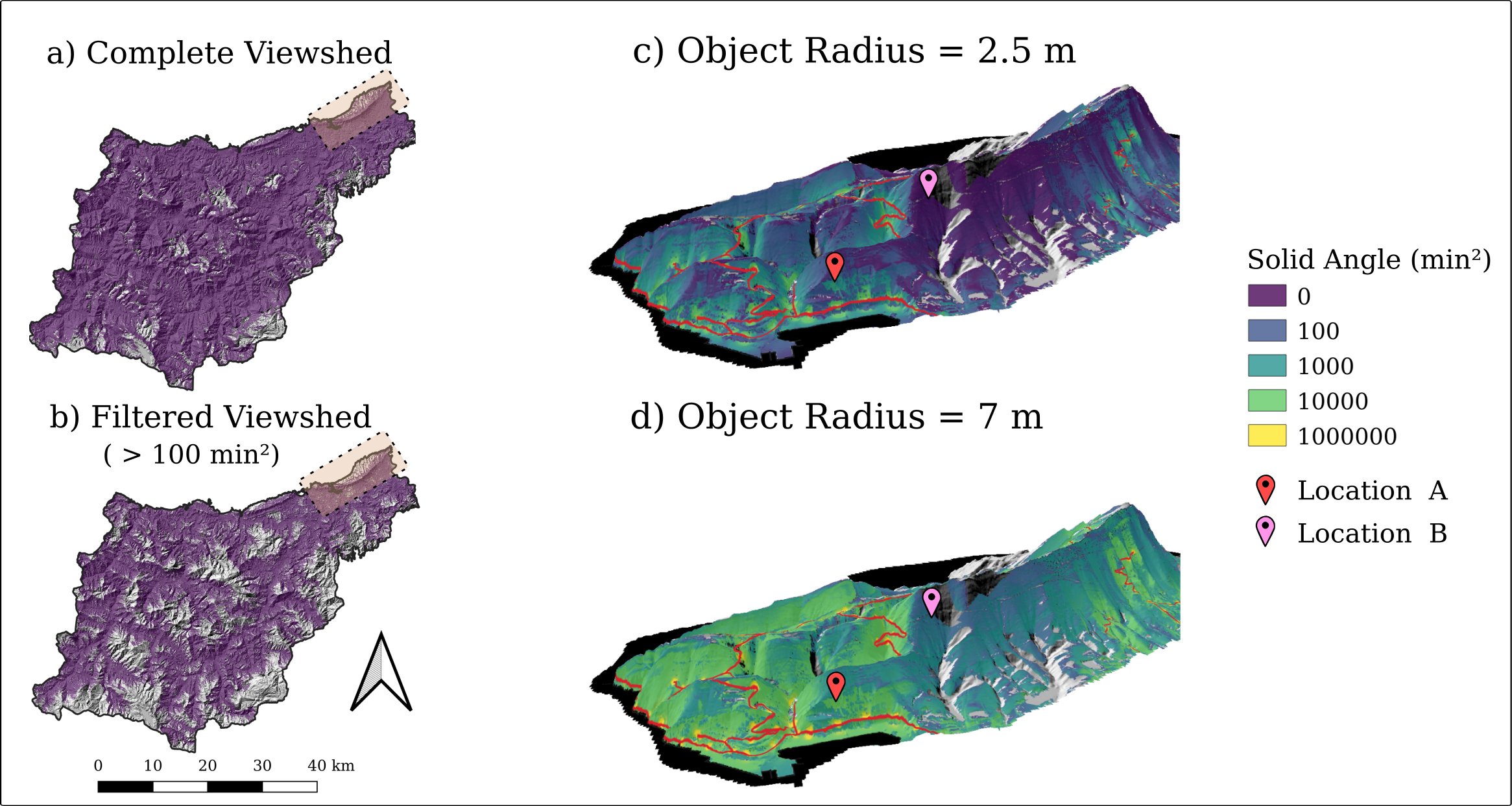
by Ivan Marchesini
Tap directly into FAIR data warehouses
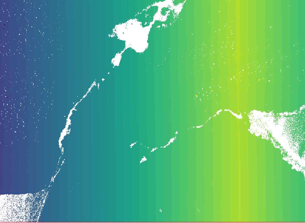
GRASS GIS understands netCDF data that follows the CF-convention
- m.crawl.thredds: Lists URLs for netCDF datasets on Thredds servers
- t.rast.import.netcdf: Makes Spatio-temporal data in netCDF format directly available for analysis in GRASS STRDS (also without downloading)
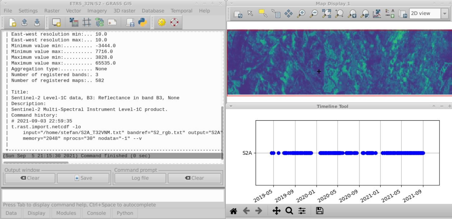
Enjoy data delivered right into your GRASS GIS database from e.g.:

by Stefan Blumentrath (Norwegian Institute for Nature Research - NINA) …
GRASS loves Remote Sensing

Dedicated tools for image processing and analysis
- 50+ core modules
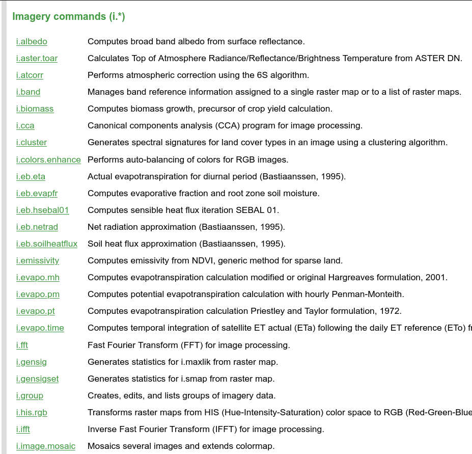
- 60+ addons, e.g., OBIA chain
Sentinel, MODIS, Landsat, NED, NAIP
Automated download and import of common datasets i.sentinel, i.modis, i.landsat, r.in.usgs, r.in.nasadem, …
by Luca Delucchi (Fondazione Edmund Mach), Martin Landa (OpenGeoLabs), Anika Weinmann (mundialis), Guido Riembauer (mundialis), Roberta Fagandini (GSoC), Zechariah Krautwurst (GSoC), Anna Petrasova (NC State University), Vaclav Petras (NC State University), Veronica Andreo (CONICET), …
GRASS Sentinel Addons
Access & Downloading → Importing → Preprocessing → Analysis
Contains modified Copernicus Sentinel data (2021)
Access & Downloading
- i.sentinel.coverage
- i.sentinel.download
- ESA Copernicus Open Access Hub
- USGS Earth Explorer
- Google Cloud Storage
Importing
- i.sentinel.import
- selection of individual bands
- import of metadata, band reference, cloud masks
- t.sentinel.import
- r.s1.grd.import
Importing
- Importing into a space-time raster dataset with t.sentinel.import
Preprocessing
- i.sentinel.mask
- t.sentinel.mask
- i.sentinel.preproc
- i.sentinel-2.sen2cor
- t.rast.mosaic
- i.sar.speckle
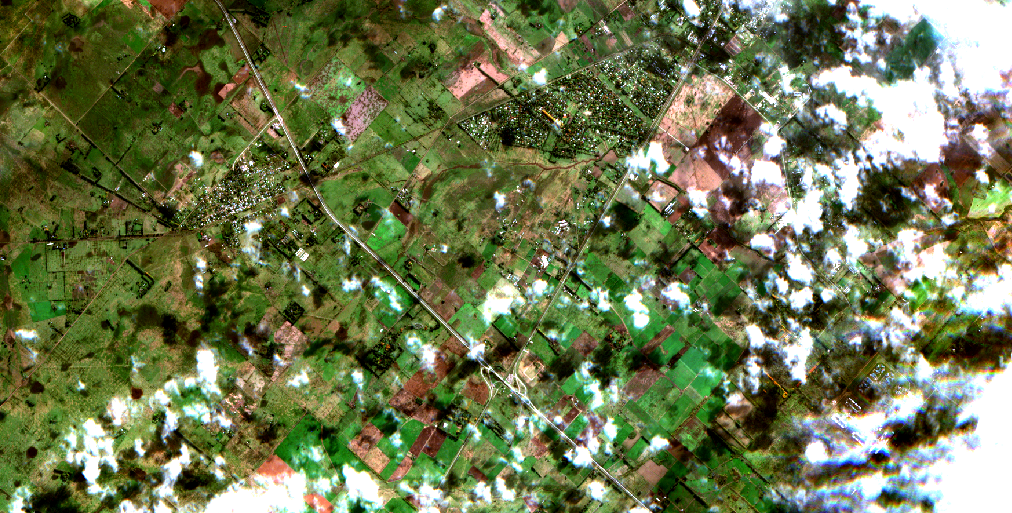
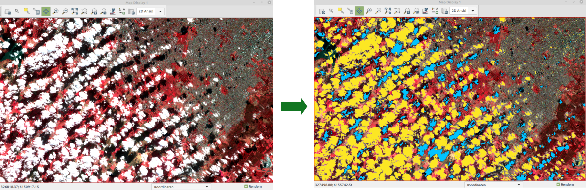
Preprocessing: cloud masking with i.sentinel.mask
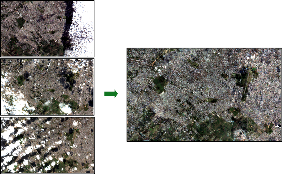
Preprocessing: temporal mosaicking with t.rast.mosaic
Preprocessing: Sentinel-1 data
- r.s1.grd.import
- requires ESA's SNAP software
- complete SAR preprocessing chain
GRASS is ready for the cloud
GRASS in docker containers
- Different flavours
- Built and updated automatically
- Can be deployed anywhere you need them
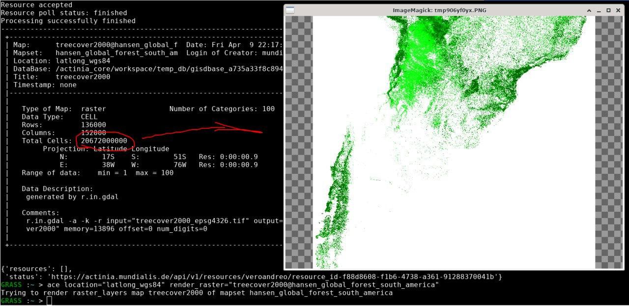
actinia: The GRASS GIS REST API
- Open source REST API for scalable, distributed, high performance processing of geo data using GRASS GIS
- More details in this FOSS4G presentation
- Wanna try? Follow this tutorial for a demo user
- Available on : https://github.com/mundialis/actinia_core

 by Markus Neteler, Carmen Tawalika, Anika Weinmann, …
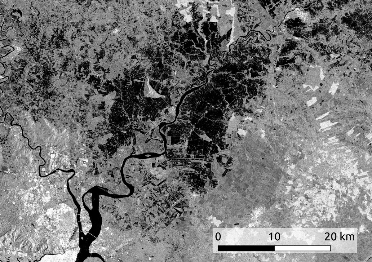
Application examples
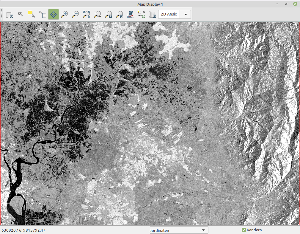
GRASS for remote sensing analysis in the cloud
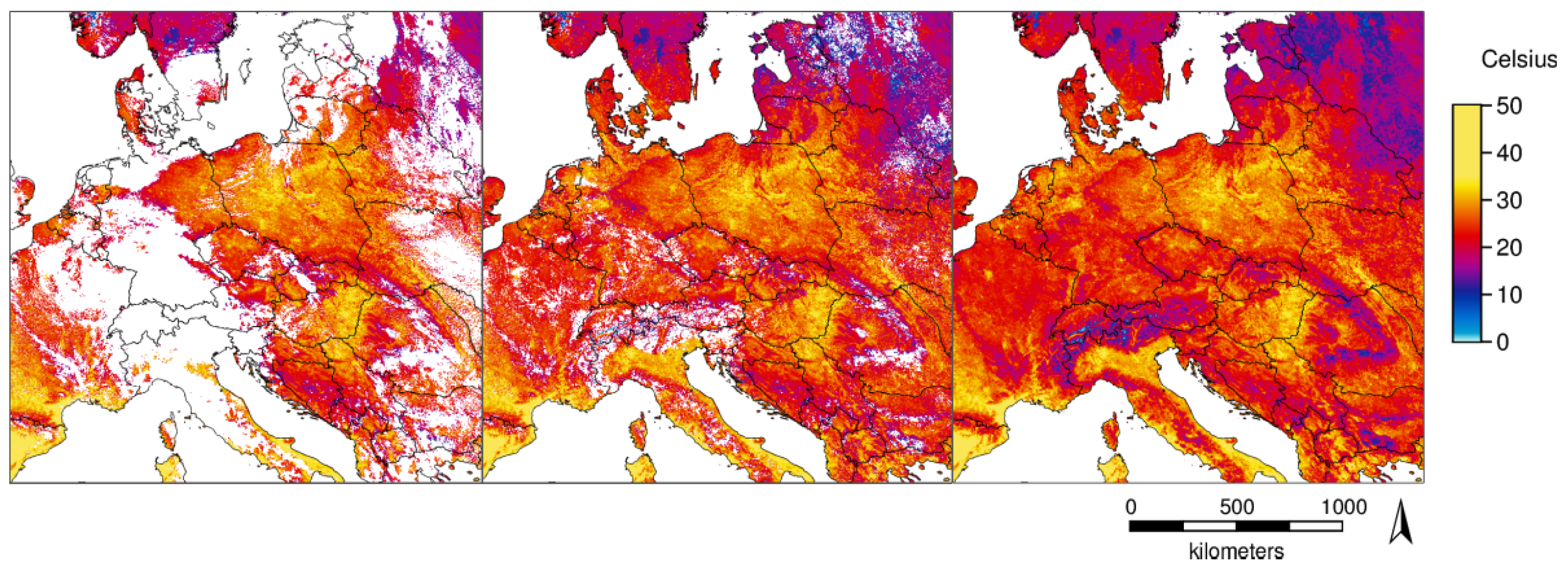
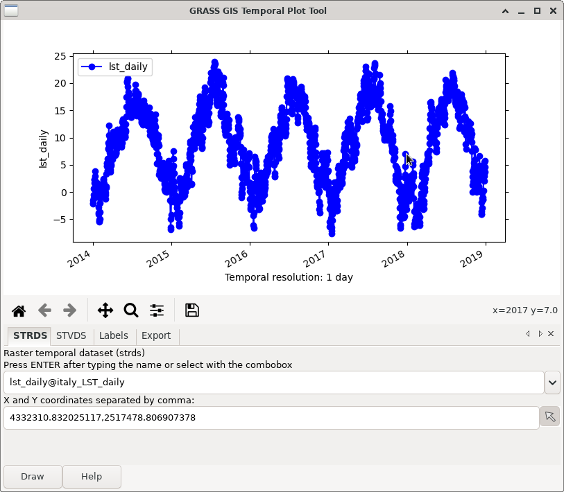
Daily LST space-time reconstruction done with GRASS - Metz et al. 2017.
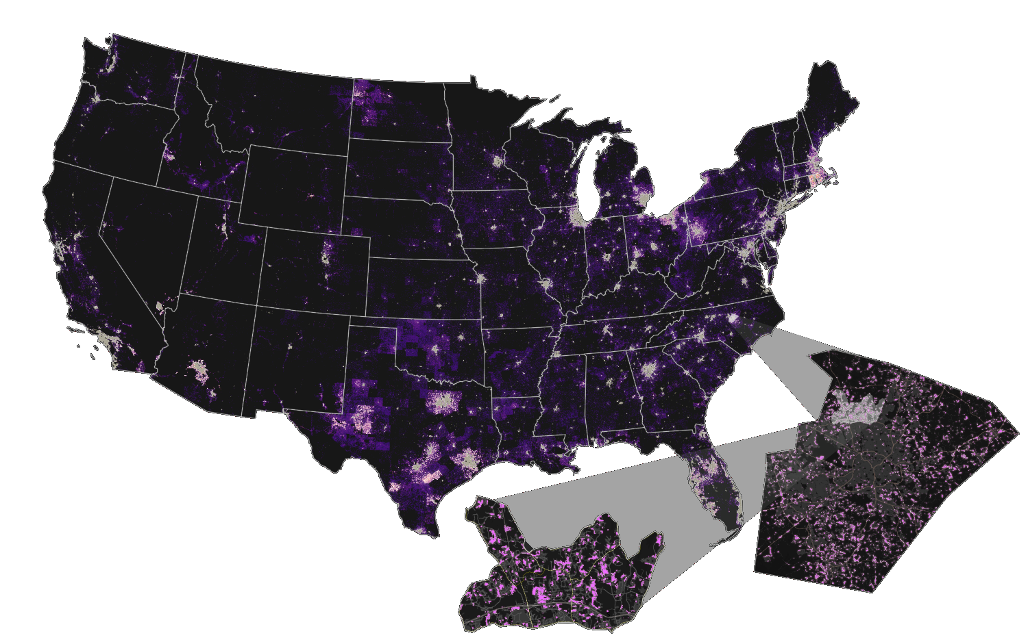
Germany land-cover mapping based on Sentinel-2 data
GRASS modules in use (excerpt):
- i.vi
- t.rast.series
- r.learn.ml2
- r.change.info
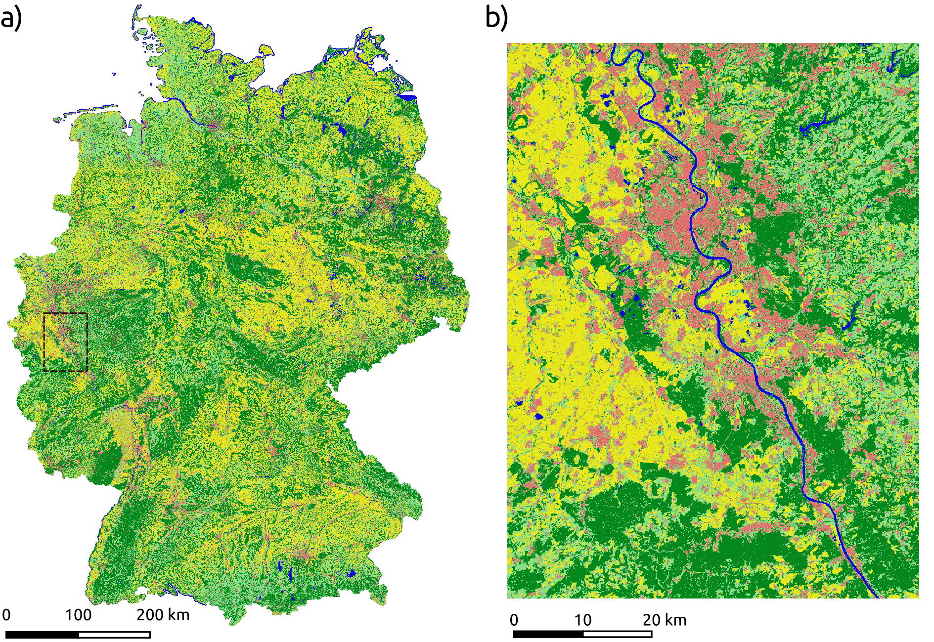
For details, follow this blog post.
Forest monitoring
GRASS modules in use (excerpt):
- r.mapcalc
- r.learn.ml2
- r.texture
- r.resamp.interp
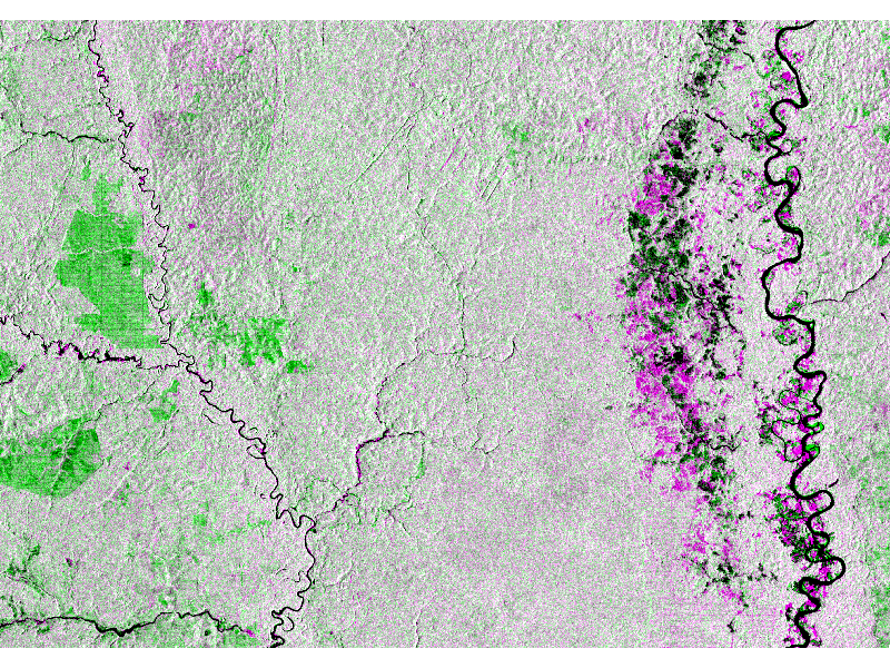 Register and try the HERMOSA demo at https://hermosa.earth
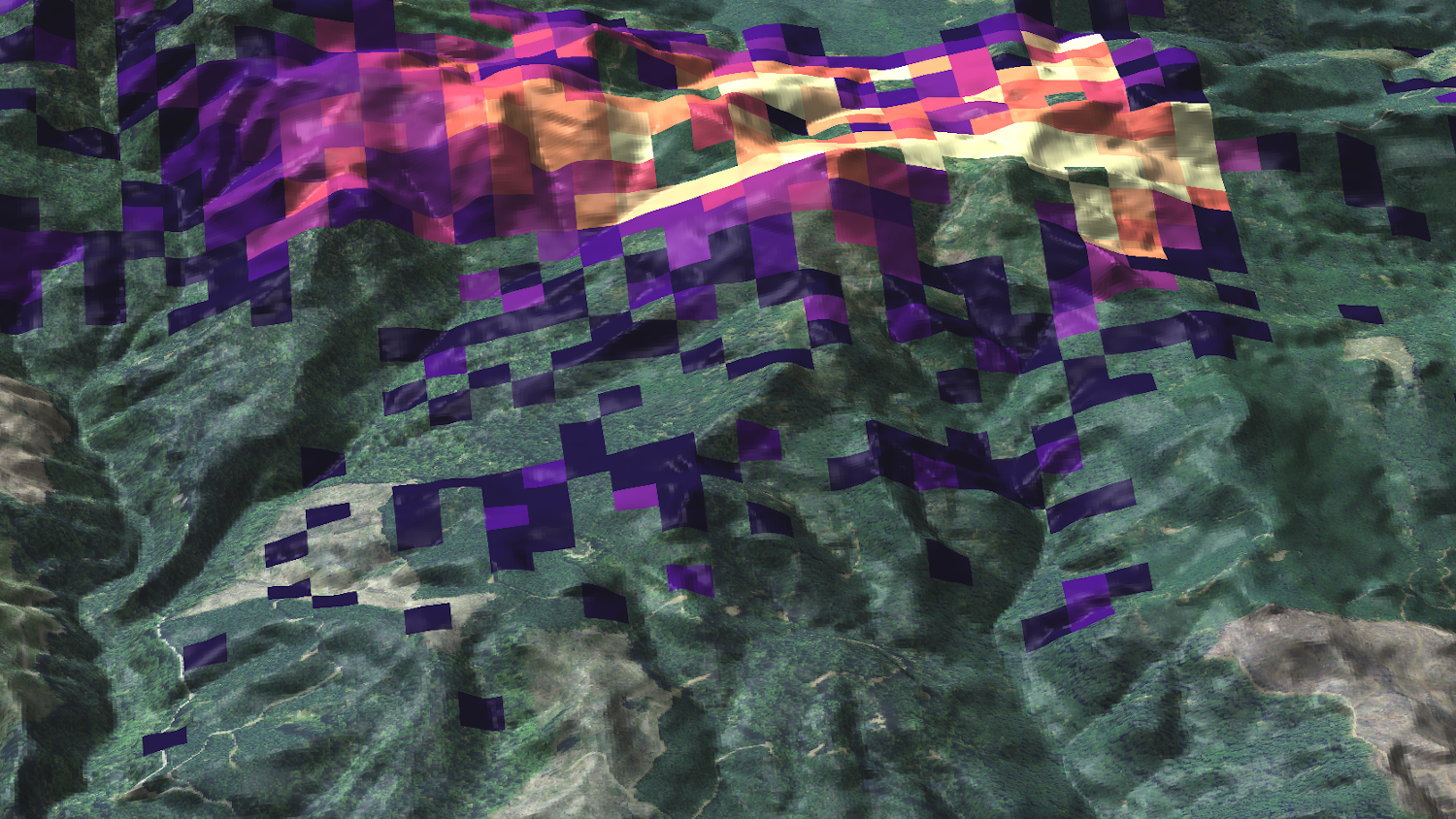
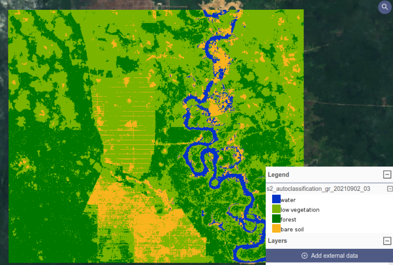
Flood Mapping in Ecuador based on Sentinel-1 data
GRASS modules in use (excerpt):
- r.mapcalc
- i.segment
- t.rast.algebra
- t.rast.series
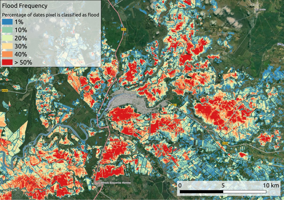 For details, follow this blog post.
Plenty of resources
- Documentation:
- Tutorials and Courses:
-
Books:
- Open Source GIS: A GRASS GIS Approach
- Tangible Modeling with Open Source GIS
- Open Source Approaches to Spatial Data Handling
Access to Source Code
Documentation links to the source code.
by Luca Delucchi
Get involved! All contributions are welcome!
Code contributions
GRASS GIS development is GitHub-centered: core, addons, website
- File bug reports or feature requests
- All issues and PR's are publicly visible
- Ask, comment, suggest also in Github Discussions
- "Fork me on GitHub" and suggest changes or fix bugs via pull requests
- Create your own addon! See this nice workshop for a guideline: How to write a Python tool for GRASS

Other contributions are relevant too!
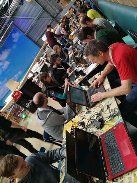
Sponsoring
- Money donations are very important for GRASS GIS development. They allow us to:
- organize face-to-face coding sessions (sprints)
- finance infrastucture needs (web site, etc)
- pay developers to implement new features and fix specific important bugs
Sponsoring
"One of the greatest benefits of GRASS GIS is that its environments gives us a plethora of options for manipulating data and testing/designing our automation/workflow processes."
https://opencollective.com/grass

Thanks for your attention!!
VeronicaAndreo
veroandreo.gitlab.io