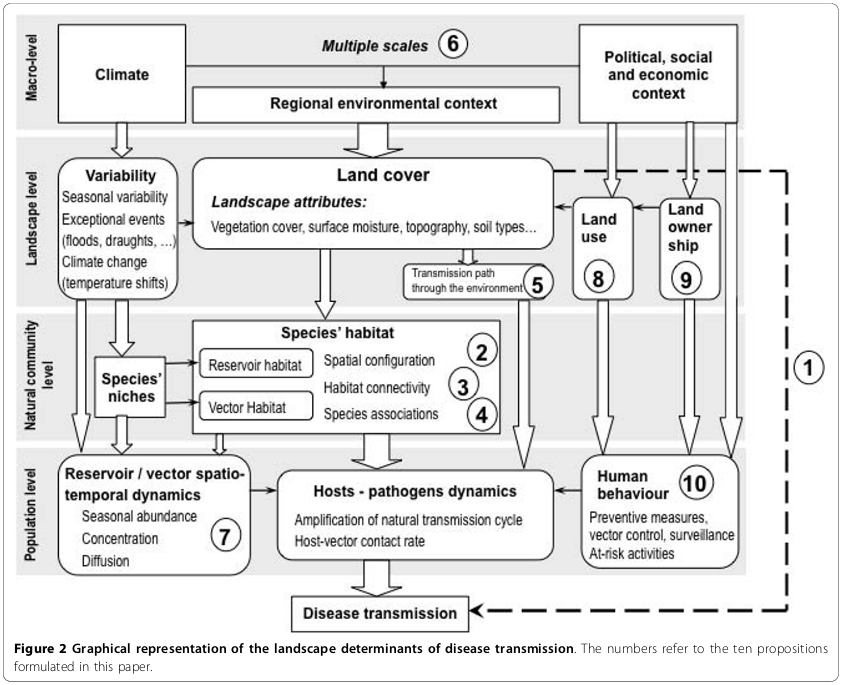
Environmental drivers of vector-borne and zoonotic diseases
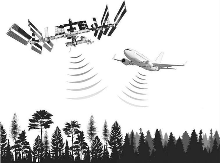
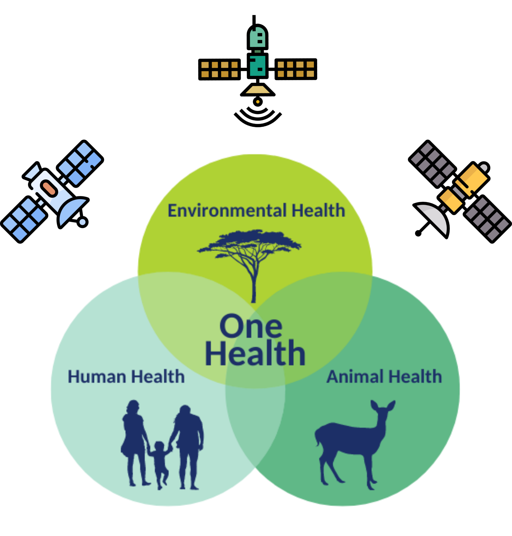
Leveraging remote sensing for Public Health
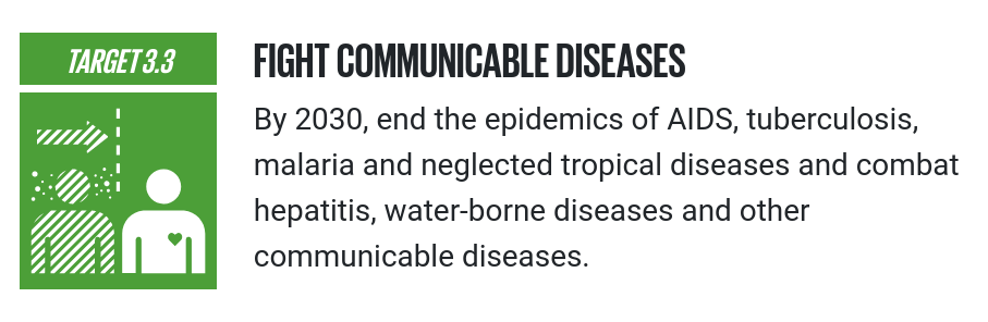
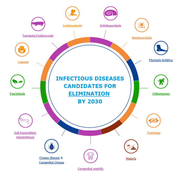
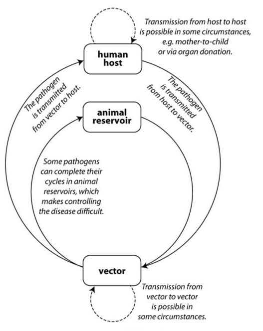
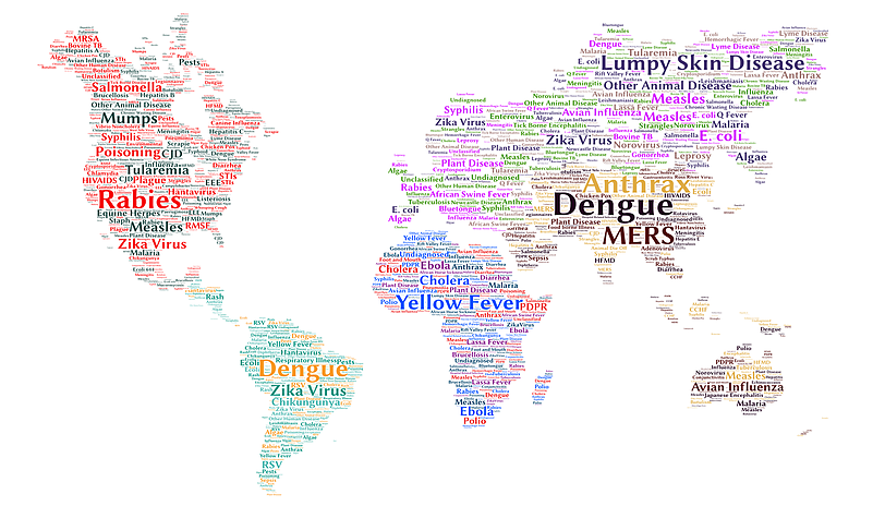
Neglected Tropical Diseases (NTD)
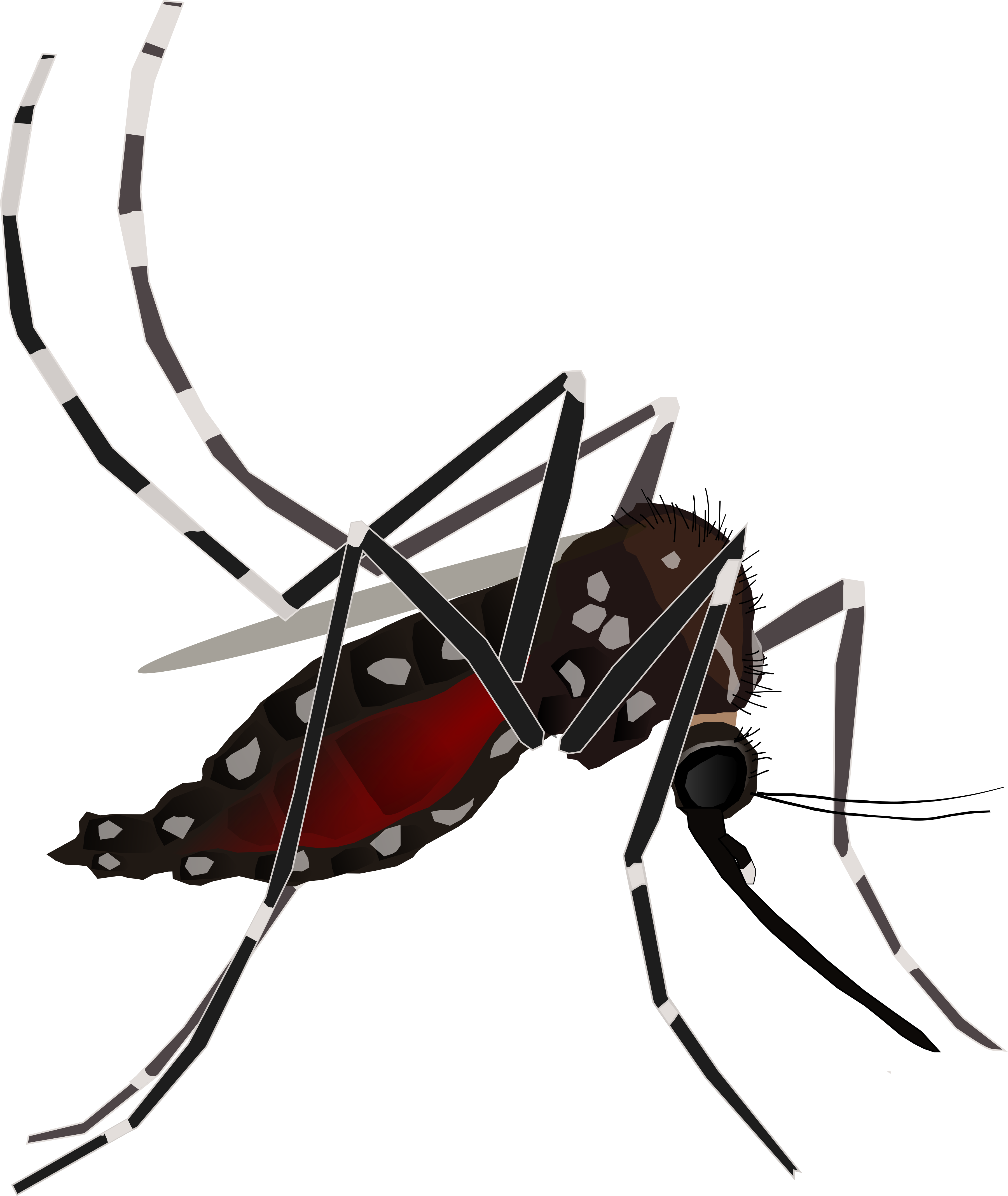
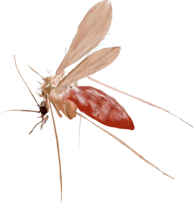
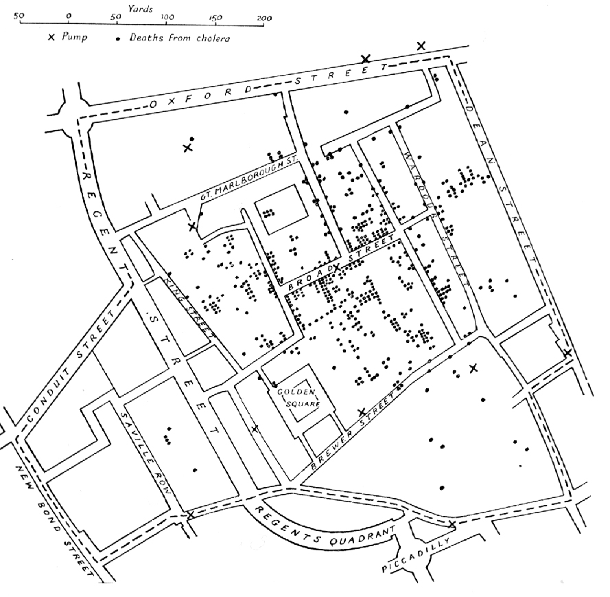
You all have seen this, right?
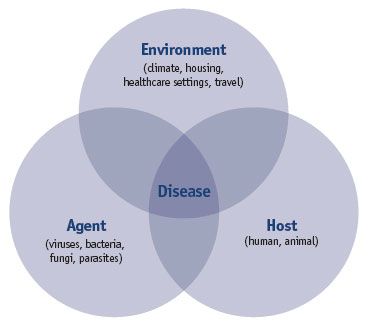
Disease Ecology I
The main objective is to understand the influence of environmental factors and to predict when and where a disease is most likely to occur
decision making, planning of prevention, management or response actions, etc.
Disease Ecology II
Use of RS in Health applications
Most common RS variables used
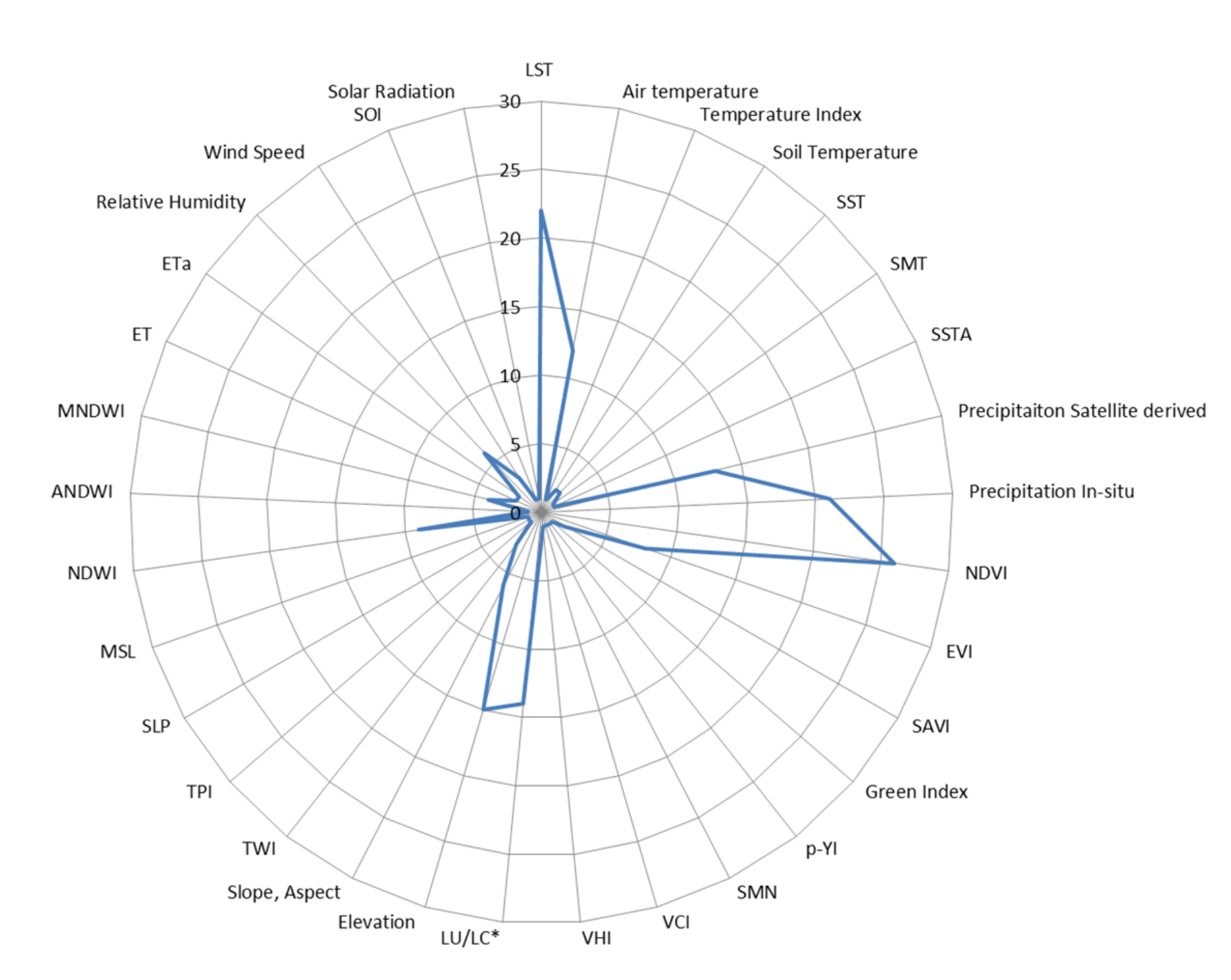
- LST
- Precipitation
- NDVI
- LULC
- Elevation
- NDWI
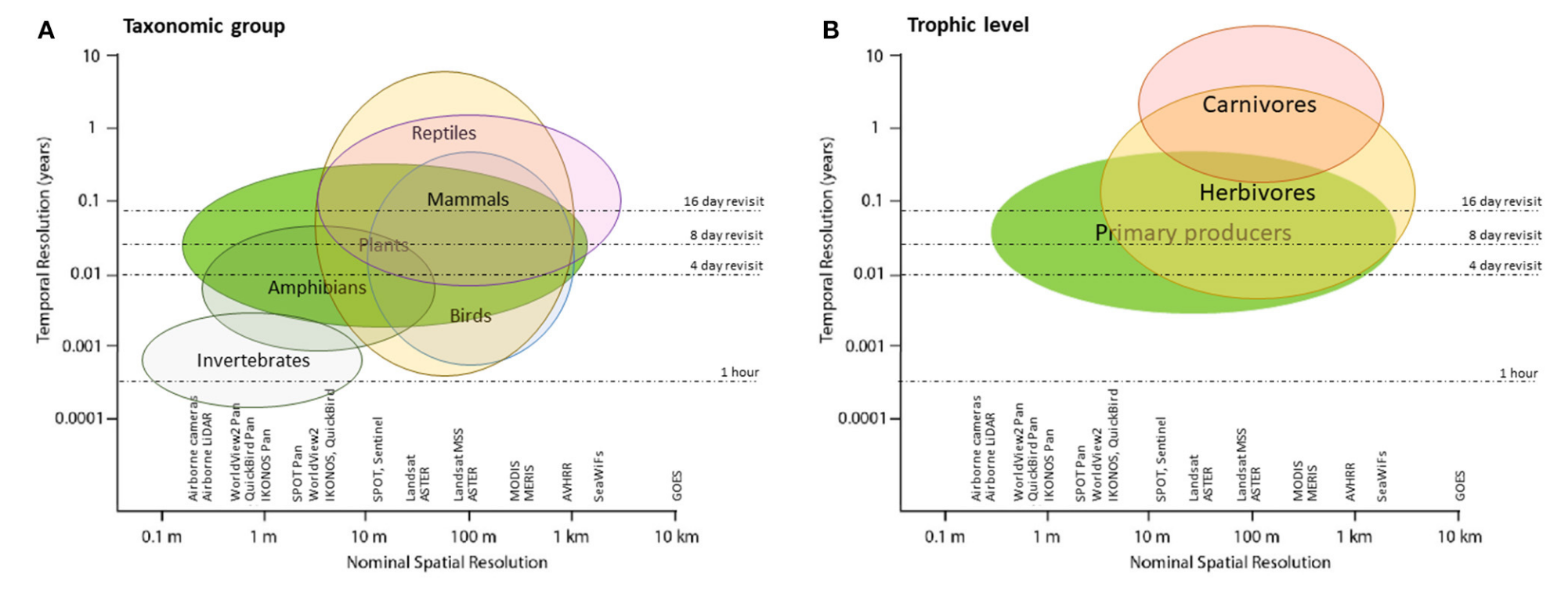
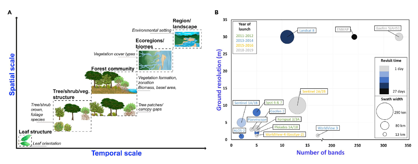
Remote sensing basic features
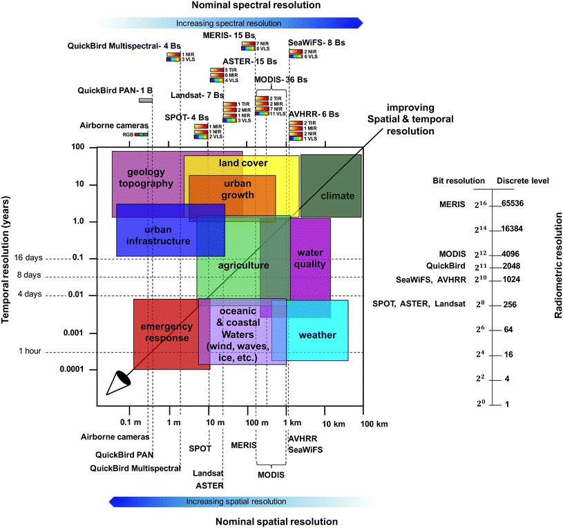
Remote sensing & scale I
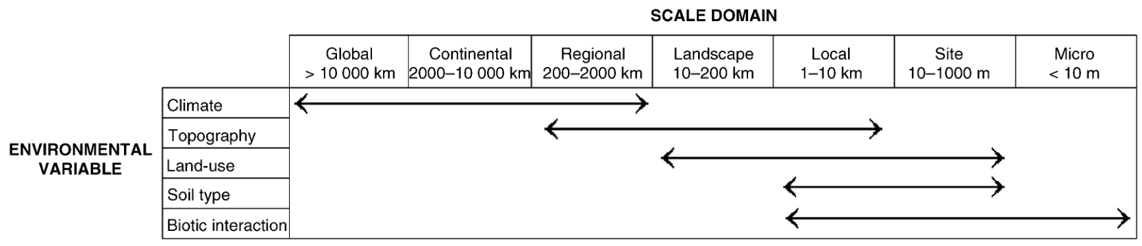
Remote sensing & scale II
How to apply RS in disease ecology?
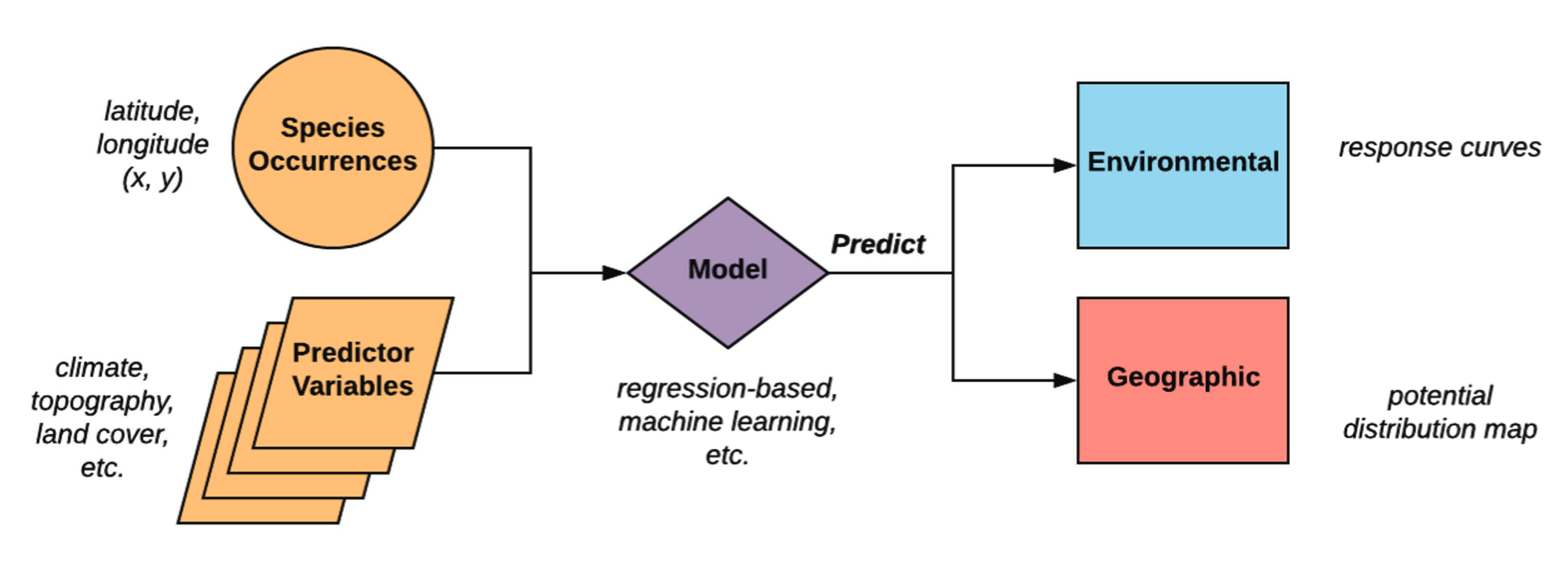
Detecting and mapping species occurrences
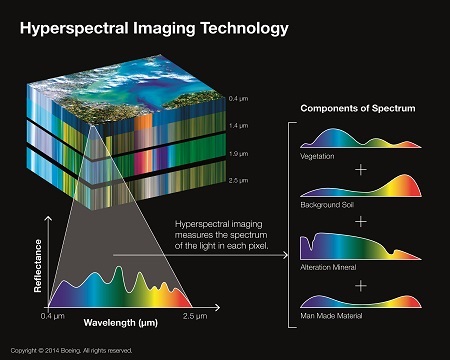
- Very high resolution (VHR) imagery
- Hyperspectral data (esp. for plant species)
- Direct and indirect counting (CV, ML, DL)
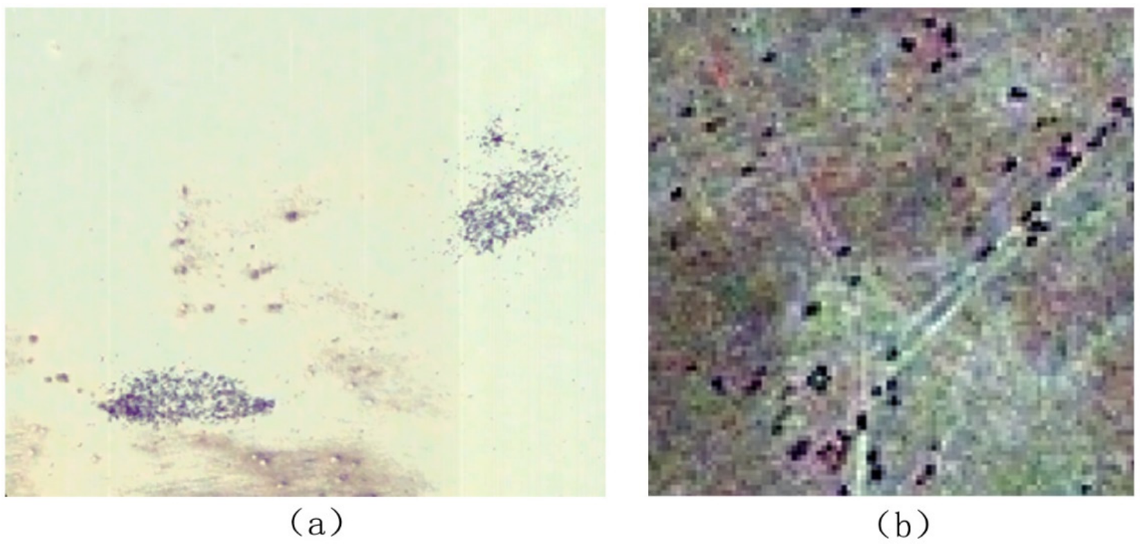
Detecting and mapping species occurrences
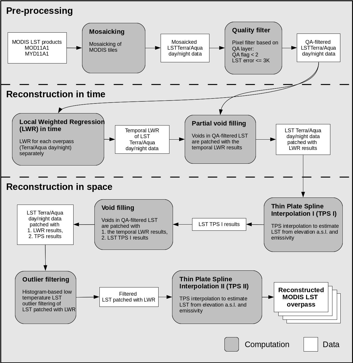
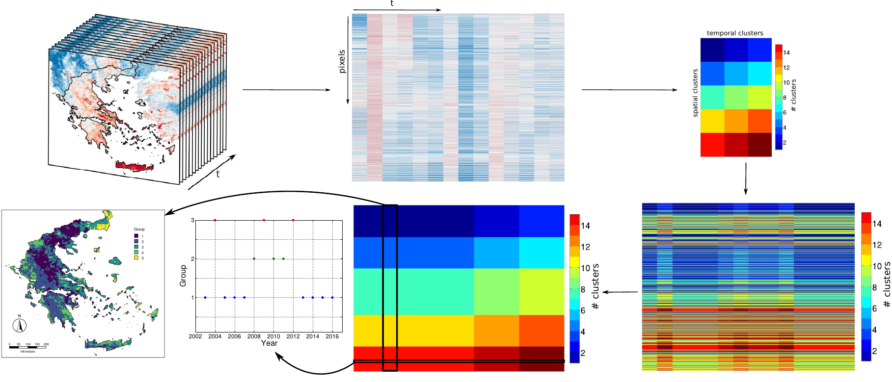
Time series analysis of satellite products
- MODIS LST temporal and spatial reconstruction (LWR & splines)
- Estimation of relevant indices (GRASS GIS temporal framework!)
- Detection of spatial and temporal clusters of favorable conditions for the occurrence of West Nile Fever cases in Greece

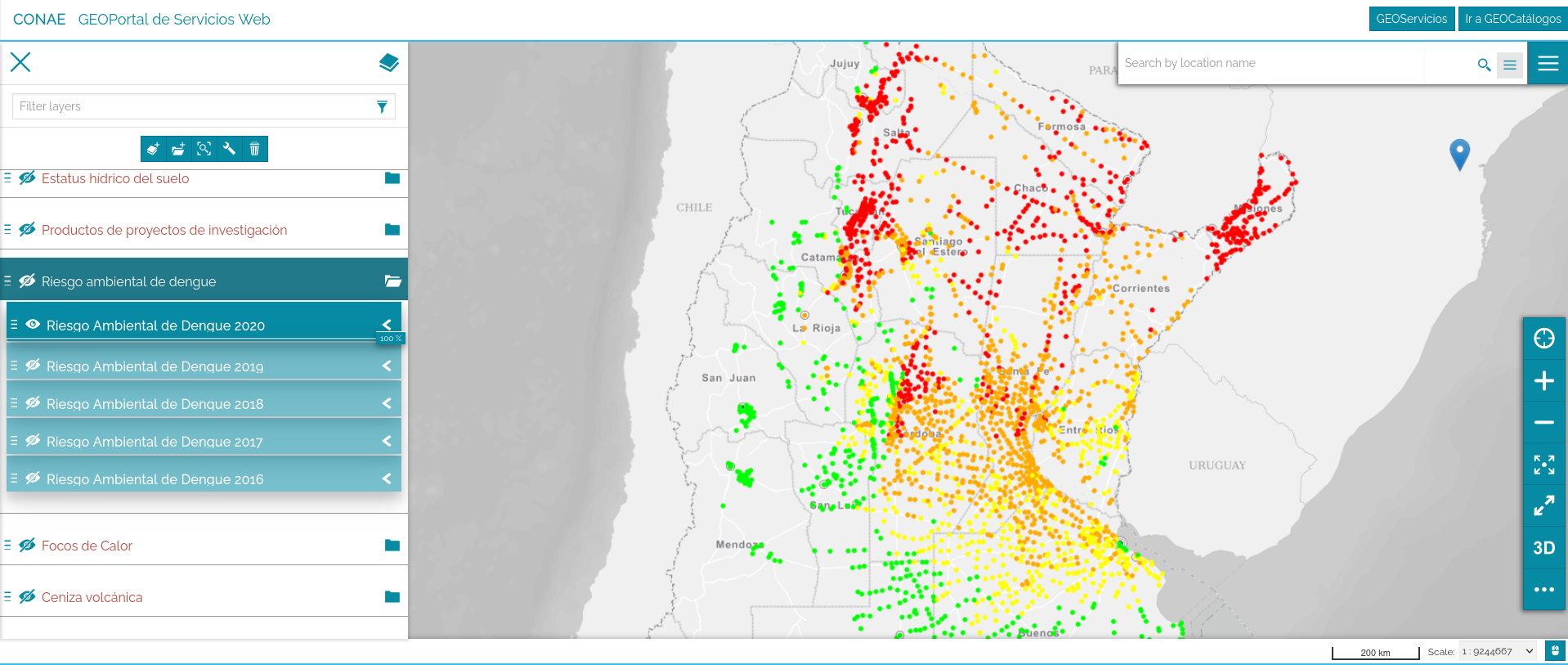
Environmental risk of Dengue
- MODIS LST is used to estimate number of extrinsic incubation periods (EIP) that virus might complete; the higher this number, the higher the environmental risk
SDM & GIS based approach for HPS risk map
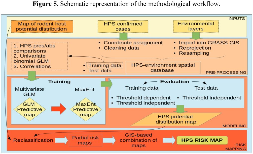
We combined a rescaled probability map of the host with one of the human cases to determine levels of transmission risk

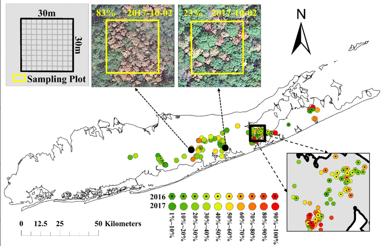
Cutaneous leishmaniasis and LULCC
![]()
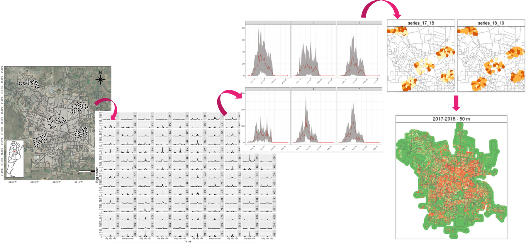
Spatial distribution of temporal patterns
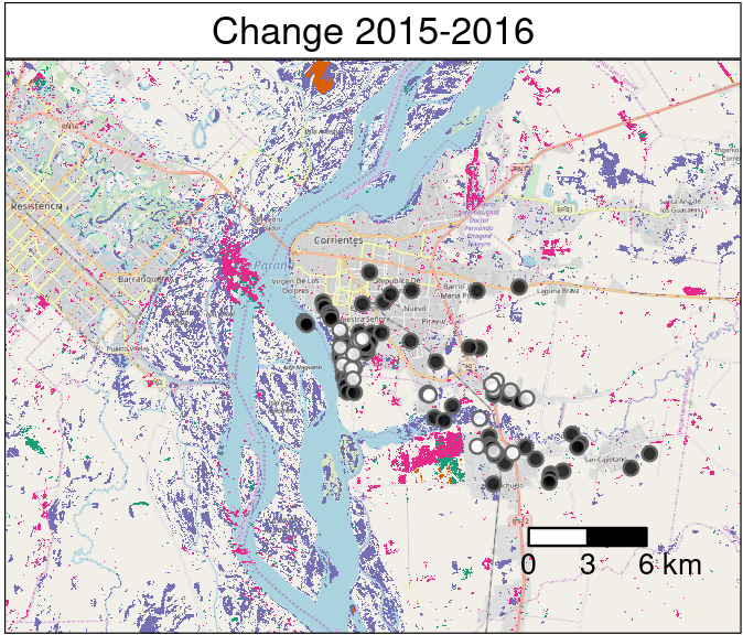
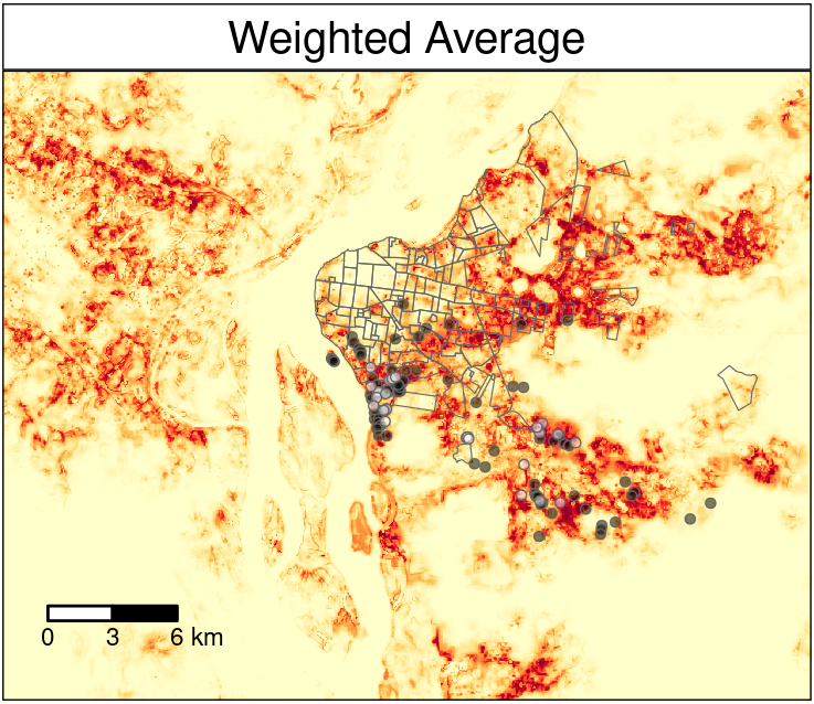
- Temporal and spatial patterns in Aedes aegypty in Córdoba
- Association with variables derived from Sentinel 2 imagery analysis to predict temporal patterns over the whole city.
![]()
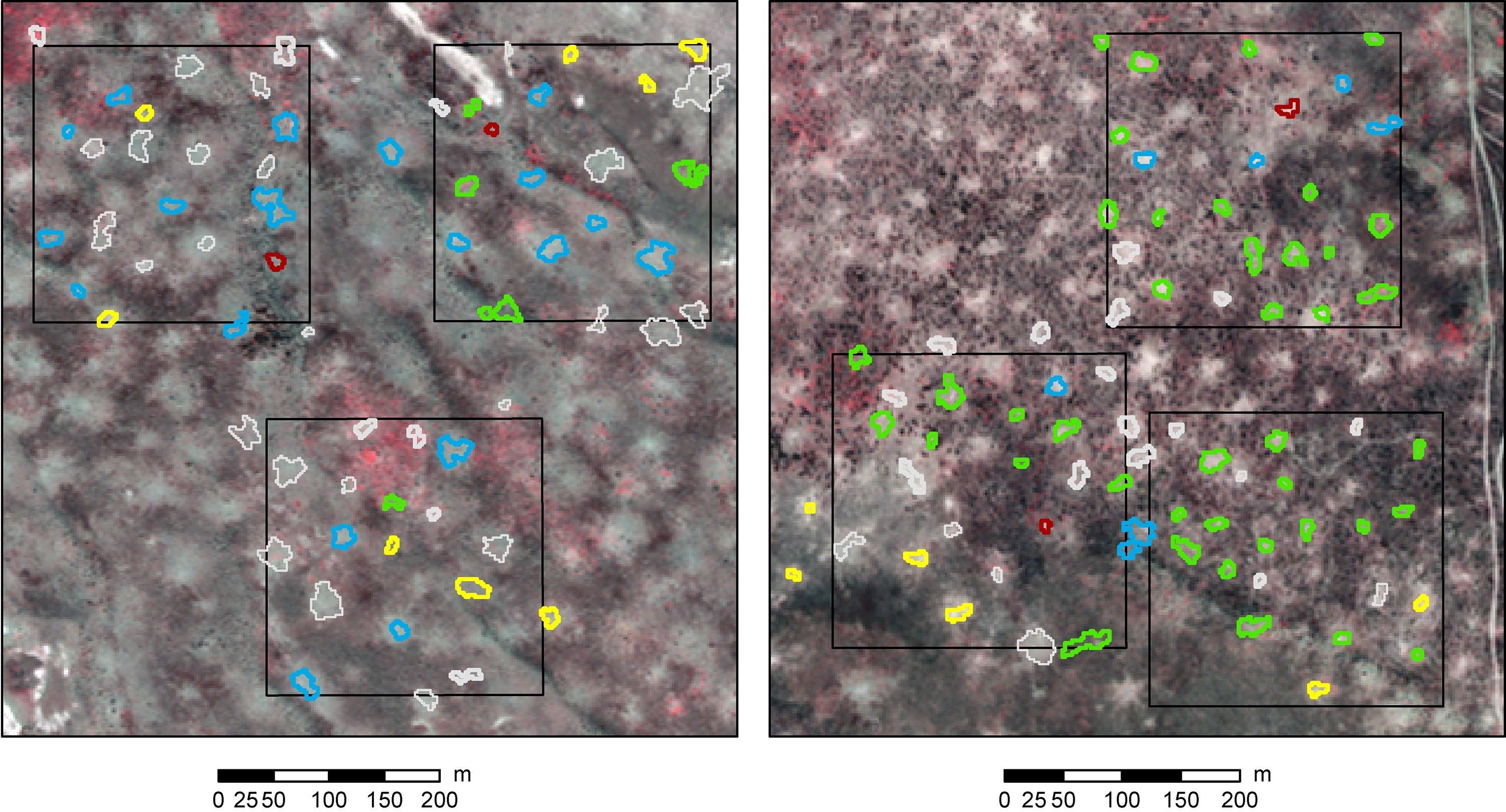
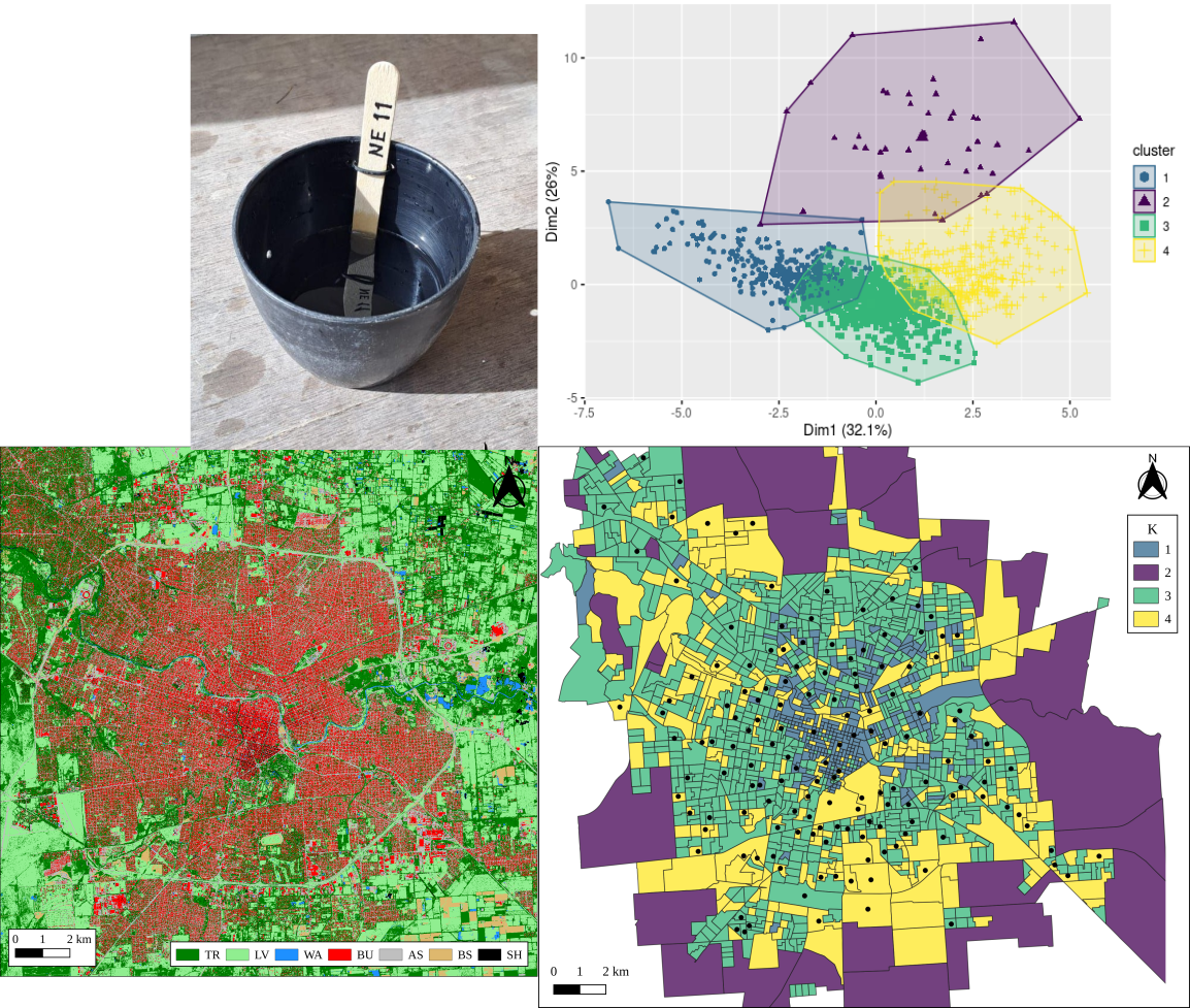
Urban environmental characterisation for the distribution of ovitraps
- Object-based classification of VHR imagery
- Landscape metrics for polygons
- Clustering to find groups of similar polygons
- Stratified distribution of ovitraps
 MSc thesis, Carla Rodriguez.
Predictive system based on population dynamics and weather forecasting
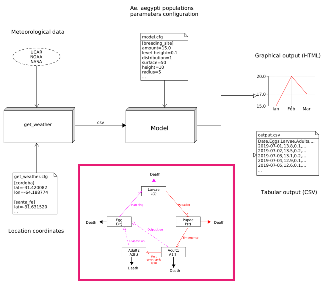
Development of an early warning system (EWS) for dengue. PhD candidate, Tomás San Miguel. 
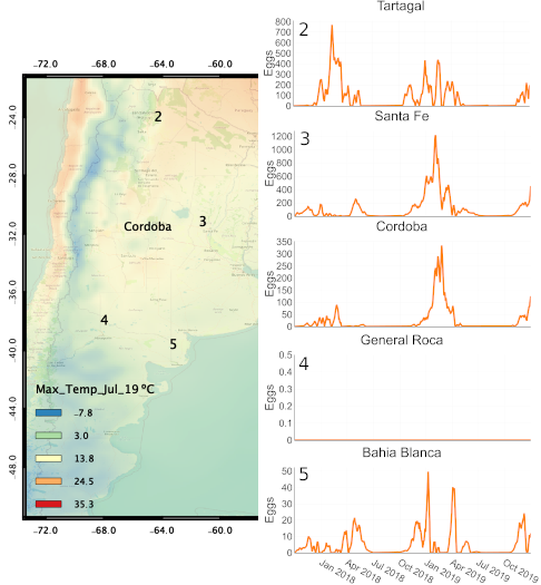
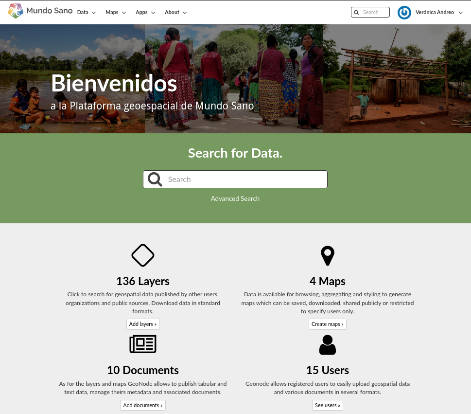
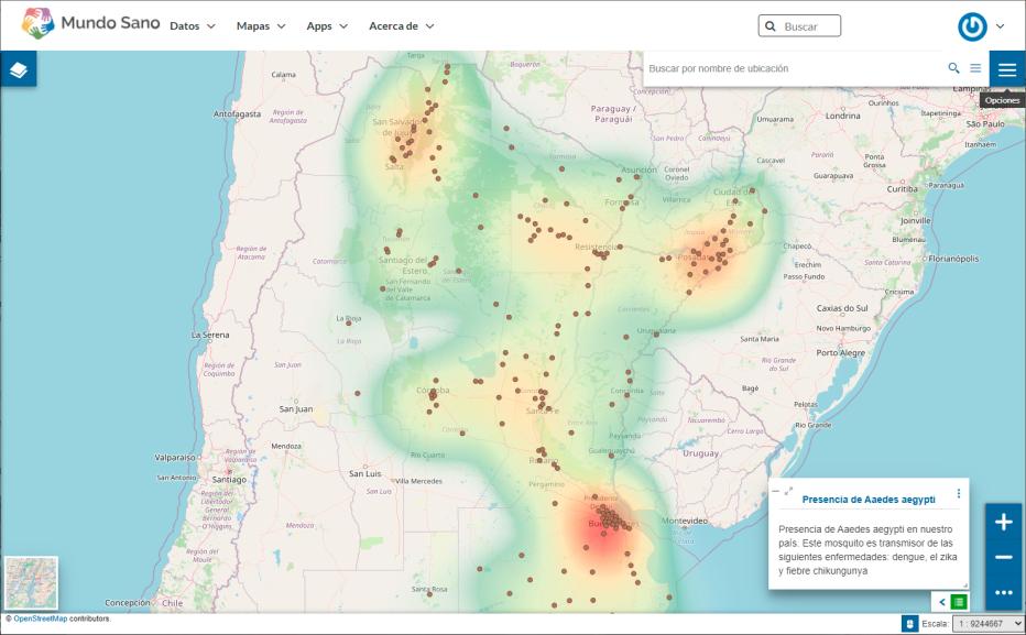
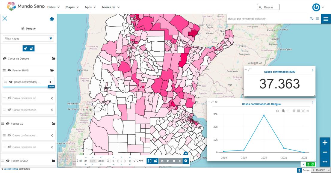
Online surveillance system
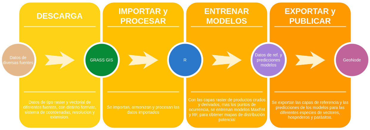

Online surveillance system
Other projects under development

Incidence of asthma as a function of remotely sensed air quality and LULCC. PhD candidate, Abraham Coiman.
Distribution of congenital diseases and access to health. PhD candidate, Carla Rodriguez Gonzalez.

Epidemiological characterisation of intestinal parasite infection in children. PhD candidate, Matias Scavuzzo.

Geospatial modelling of malnutrition in children and adolescents. PhD candidate, Micaela Campero.


Environmental variables associated with non-communicable diseases. Dr. Juan Diego Pinotti and Dr. Ximena Porcasi.
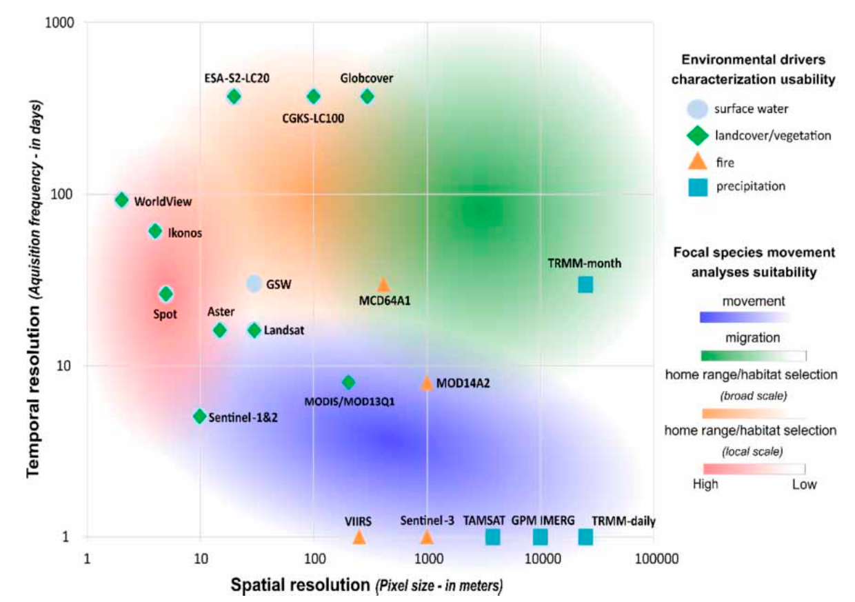
Challenges and gaps - RS
- Trade-off between different RS resolutions, the problem under study, the data and methods available
- Gaps in optical RS: clouds, shadows in optical RS (spatial and temporal interpolations)
- Need for corrections if high level data is not suitable
- Limited access to VHR, LiDAR, Hyper-spectral (US$, tricky to scale yet)
- Investment and capacity building: huge volumes of data vs. limited bandwidth, storage and computational capacity (cloud computing, parallelisation | resources)
Field data will always be needed! :)
Opportunities: low hanging fruits?
- SAR data to avoid clouds, e.g., SAOCOM to estimate soil moisture
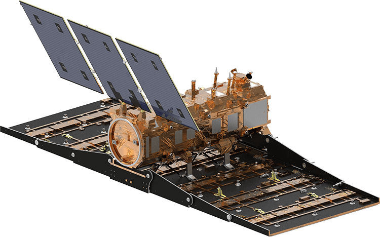
- Open LiDAR data, e.g., GEDI onboard of ISS
- Open source solutions for the cloud openEO.cloud, actinia, OpenPlains? ;-)
![]()
![]()
New missions: hyper-spectral for all
- A number of recent and upcoming missions for hyper-spectral data: PRISMA (recently made open), EnMap, CHIME, TIRS
![]()
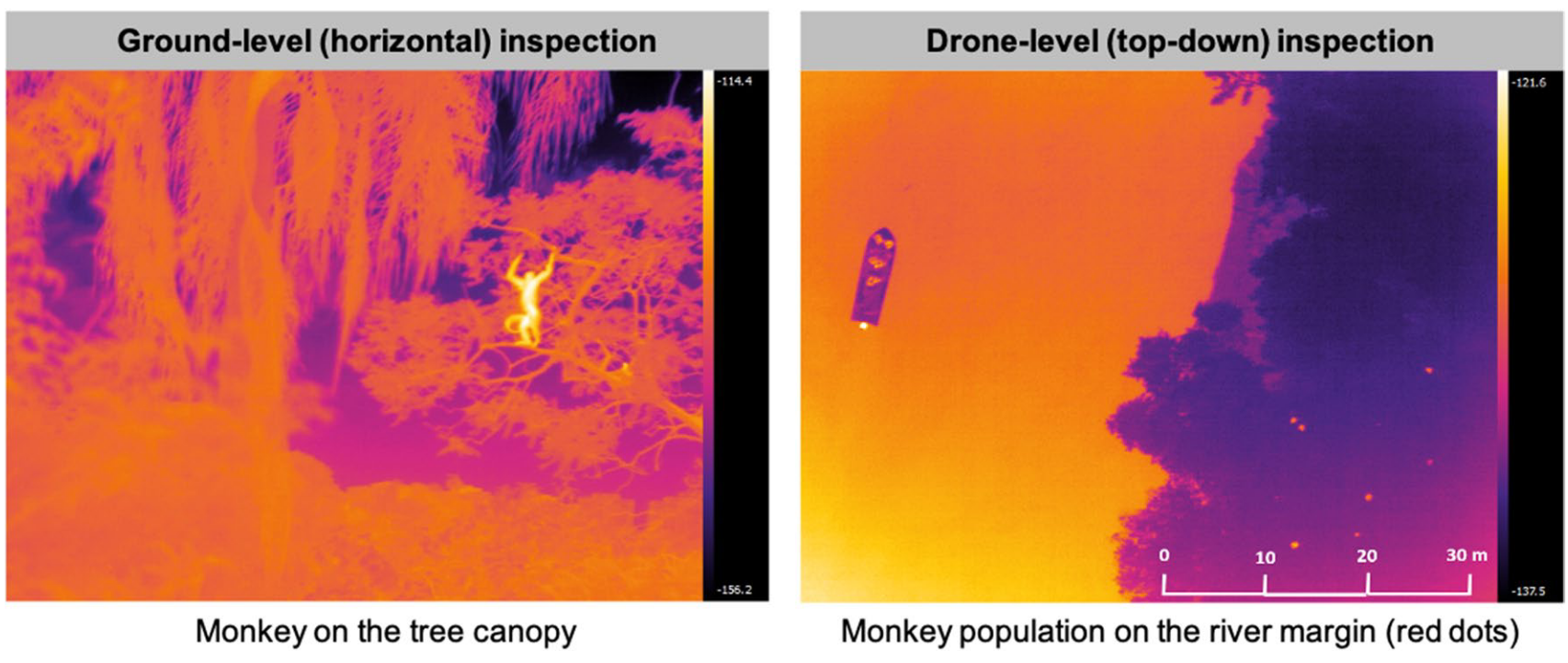
Specialized cameras onboard drones
- Cheaper UAVs with different types of cameras, e.g. thermal multi- or hyper-spectral sensors to detect and count animals in inaccessible places
Thanks!

Unhealthy lab

References
Aguirre, E., Andreo, V., Porcasi, X., Lopez, L., Guzman, C., González, P., and Scavuzzo, C. M. (2021), “Implementation of a proactive system to monitor Aedes aegypti populations using open access historical and forecasted meteorological data,” Ecological Informatics, 64, 101351. https://doi.org/10.1016/j.ecoinf.2021.101351.
Andreo, V., Glass, G., Shields, T., Provensal, C., and Polop, J. (2011), “Modeling Potential Distribution of Oligoryzomys longicaudatus, the Andes Virus (Genus: Hantavirus) Reservoir, in Argentina,” EcoHealth, 8, 332–348.
Andreo, V., Izquierdo-Verdiguier, E., Zurita-Milla, R., Rosa, R., Rizzoli, A., and Papa, A. (2018), “Identifying Favorable Spatio-Temporal Conditions for West Nile Virus Outbreaks by Co-Clustering of Modis LST Indices Time Series,” in IGARSS 2018 - 2018 IEEE International Geoscience and Remote Sensing Symposium, Valencia: IEEE, pp. 4670–4673. https://doi.org/10.1109/IGARSS.2018.8519542.
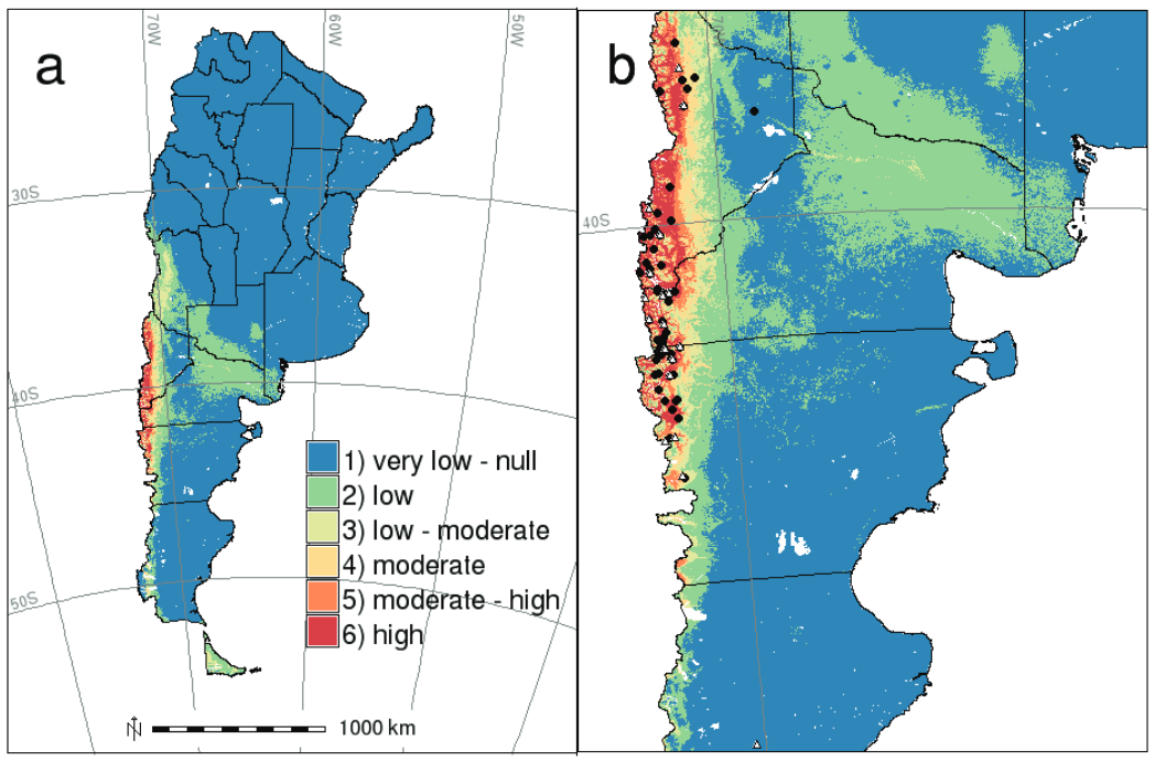
Andreo, V., Neteler, M., Rocchini, D., Provensal, C., Levis, S., Porcasi, X., Rizzoli, A., Lanfri, M., Scavuzzo, M., Pini, N., Enria, D., and Polop, J. (2014), “Estimating Hantavirus Risk in Southern Argentina: A GIS-Based Approach Combining Human Cases and Host Distribution,” Viruses, 6, 201–222. https://doi.org/10.3390/v6010201.
Andreo, V., Porcasi, X., Guzman, C., Lopez, L., and Scavuzzo, C. M. (2021), “Spatial Distribution of Aedes aegypti Oviposition Temporal Patterns and Their Relationship with Environment and Dengue Incidence,” Insects, 12, 919. https://doi.org/10.3390/insects12100919.
Andreo, V., Rosa, J., Ramos, K., and Salomón, O. D. (2022), “Ecological characterization of a cutaneous leishmaniasis outbreak through remotely sensed land cover changes,” Geospatial Health, 17. https://doi.org/10.4081/gh.2022.1033.
Carrasco-Escobar, G., Moreno, M., Fornace, K., Herrera-Varela, M., Manrique, E., and Conn, J. E. (2022), “The use of drones for mosquito surveillance and control,” Parasites & Vectors, 15, 473. https://doi.org/10.1186/s13071-022-05580-5.
Georganos, S., Grippa, T., Lennert, M., Vanhuysse, S., and Johnson, B. A. (2018), “Scale Matters: Spatially Partitioned Unsupervised Segmentation Parameter Optimization for Large and Heterogeneous Satellite Images,” 23.
Grippa, T., Lennert, M., Beaumont, B., Vanhuysse, S., Stephenne, N., Wolff, E., Grippa, T., Lennert, M., Beaumont, B., Vanhuysse, S., Stephenne, N., and Wolff, E. (2017), “An Open-Source Semi-Automated Processing Chain for Urban Object-Based Classification,” Remote Sensing, 9, 358. https://doi.org/10.3390/rs9040358.
Kasampalis, D. A., Alexandridis, T. K., Deva, C., Challinor, A., Moshou, D., and Zalidis, G. (2018), “Contribution of remote sensing on crop models: A review,” Journal of Imaging, 4, 52. https://doi.org/10.3390/jimaging4040052.
Lambin, E. F., Tran, A., Vanwambeke, S. O., Linard, C., and Soti, V. (2010), “Pathogenic landscapes: Interactions between land, people, disease vectors, and their animal hosts,” International Journal of Health Geographics, 9, 54. https://doi.org/10.1186/1476-072X-9-54.
Lechner, A. M., Foody, G. M., and Boyd, D. S. (2020), “Applications in Remote Sensing to Forest Ecology and Management,” One Earth, 2, 405–412. https://doi.org/10.1016/j.oneear.2020.05.001.
Leitão, P. J., and Santos, M. J. (2019), “Improving models of species ecological niches: A remote sensing overview,” Frontiers in Ecology and Evolution, 7. https://doi.org/10.3389/fevo.2019.00009.
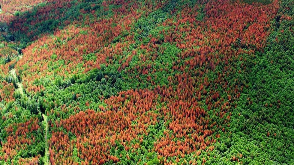
Meng, R., Gao, R., Zhao, F., Huang, C., Sun, R., Lv, Z., and Huang, Z. (2022), “Landsat-based monitoring of southern pine beetle infestation severity and severity change in a temperate mixed forest,” Remote Sensing of Environment, 269, 112847. https://doi.org/10.1016/j.rse.2021.112847.
Metz, M., Andreo, V., and Neteler, M. (2017), “A New Fully Gap-Free Time Series of Land Surface Temperature from MODIS LST Data,” Remote Sensing, 9, 1333. https://doi.org/10.3390/rs9121333.
Parselia, E., Kontoes, C., Tsouni, A., Hadjichristodoulou, C., Kioutsioukis, I., Magiorkinis, G., and Stilianakis, N. I. (2019), “Satellite Earth Observation Data in Epidemiological Modeling of Malaria, Dengue and West Nile Virus: A Scoping Review,” Remote Sensing, 11, 1862. https://doi.org/10.3390/rs11161862.
Pearson, R. G., and Dawson, T. P. (2003), “Predicting the impacts of climate change on the distribution of species: Are bioclimate envelope models useful?” Global Ecology and Biogeography, 12, 361–371. https://doi.org/10.1046/j.1466-822X.2003.00042.x.
Porcasi, X., Rotela, C. H., Introini, M. V., Frutos, N., Lanfri, S., Peralta, G., De Elia, E. A., Lanfri, M. A., and Scavuzzo, C. M. (2012), “An operative dengue risk stratification system in Argentina based on geospatial technology,” Geospatial Health, 6, S31–S42. https://doi.org/10.4081/gh.2012.120.
Rumiano, F., Wielgus, E., Miguel, E., Chamaillé-Jammes, S., Valls-Fox, H., Cornélis, D., Garine-Wichatitsky, M. D., Fritz, H., Caron, A., and Tran, A. (2020), “Remote sensing of environmental drivers influencing the movement ecology of sympatric wild and domestic ungulates in semi-arid savannas, a review,” Remote Sensing, 12. https://doi.org/10.3390/rs12193218.
Torresani, M., Rocchini, D., Alberti, A., Moudrý, V., Heym, M., Thouverai, E., Kacic, P., and Tomelleri, E. (2023), “LiDAR GEDI derived tree canopy height heterogeneity reveals patterns of biodiversity in forest ecosystems,” Ecological Informatics, 102082. https://doi.org/10.1016/j.ecoinf.2023.102082.
Viana, J., Santos, J. V., Neiva, R. M., Souza, J., Duarte, L., Teodoro, A. C., and Freitas, A. (2017), “Remote Sensing in Human Health: A 10-Year Bibliometric Analysis,” Remote Sensing, 9, 1225. https://doi.org/10.3390/rs9121225.
Wang, D., Shao, Q., and Yue, H. (2019), “Surveying Wild Animals from Satellites, Manned Aircraft and Unmanned Aerial Systems (UASs): A Review,” Remote Sensing, 11, 1308. https://doi.org/10.3390/rs11111308.